Walking in Almeria
Almeria - Andalucia - Southern Spain 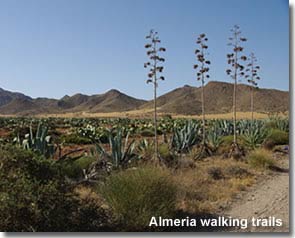
Almeria province is home to innumerable walking and hiking trails, the essence of which are the captivating and varied landscapes. The rural routes traverse the countryside through the natural parks, mountains and valleys, even the desert canyons, and not forgetting the extensive coastline, each terrain allowing the traveller an away from it all adventure to enjoy an abundance of birds, plants and wildlife and take pleasure from the unique scenery. Many trails pass through traditional Andalucian villages, places of historical interest with a wealth of culture and friendly locals. All the pathways of the province providing a new and wondrous experience.
A large number of the walking trails in Almeria are signposted and documented. 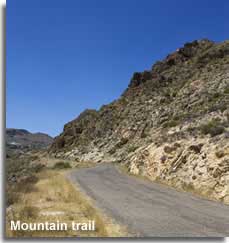 This page is dedicated to providing information on such walks, presenting the location and starting point with a brief itinerary and offering links to further details.
Choose Almeria for walking holidays in Spain
Independent, self guided, walking, trekking, and hiking holidays in the natural landscapes of Almeria...
Should the walking trails of Almeria inspire a walking themed holiday then the Choose Almeria property search, access to which is provided from the side bar or the links at the end of the page, offers holiday accommodation listings searchable by location among other criteria.
Walking, trekking and hiking routes in Almeria
Quick links - walking routes / trails of Almeria:
The list is compiled by destination.
- Cabo de Gata natural park
- Almerimar - Roquetas de Mar - Punta Entinas - Sabinar nature reserve
- Roquetas de Mar Cañada Real natural area
- Sierra Alhamilla mountain range
- Sierra de las Estancias mountain range
- Sierra de los Filabres mountain range
- Sierra Gador mountain range
- Sierra Maria-Velez natural park
- Sierra Nevada nature park and the Alpujarra Almeriense
- Sorbas Gypsum Karst natural area
- Tabernas Desert
- Valle de Almanzora valley
- PR & SL routes local walking trails for the towns and village in Almeria province
- GR routes extendable walking trails through the province and beyond
Trail Difficulty Classifications
Many of the signposted walking trails have their route charted on an information board which is displayed at the starting point, these placards also indicate key factors of the route such as distance and approximate time scale for completion. The difficulty level of a route can be described by two different methods, the first is self explanatory, the trail is either of low, medium or high difficulty, the second method, El Metodo de Informacion De Excursiones or M.I.D.E. needs a little explanation.
The M.I.D.E. is a series of four numbers on a scale of difficulty between one and five, with one being the least difficult. The four numbers relate to different aspects of the trail, as follows:
1. the developing severity of the natural trail
2. the orientation of the itinerary
3. the difficulty of the terrain type over the distance of the trail or climb
4. the effort required to carry out the excursion
These measures are based on general conditions and exclude external influences such as the weather, an easy mountain route would become much more difficult in the winter snow.
It may sounds crazy talking of snow in a region renowned for its sunshine, but with the high altitudes of the mountain ranges the peaks often see snow in the winter time, adding a new dimension to the already stunning scenery.
The following Spanish words are often used on the walking trail information boards:
Walking in the Natural Landscapes of Almeria:
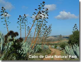
Walking in the Cabo de Gata Natural Park
Parque Natural de Cabo de Gata is an out of the way dream walking destination, with some varied and interesting trails.
A wild and rugged terrain, volcanic in nature, with mountain formations and an astonishing coastline, the protected landscapes are host to an unforeseen array of flora and fauna. The cultural ancestry of the area is apparent in its historical buildings, towers, castles, water wells and windmills, and the region is scattered with whitewashed villages both inland and coastal.
Signposted Walking Trails of Cabo de Gata
There are sixteen signposted walking routes located within the natural park, each documented by the Junta de Andalucia, all offer something different and very special.
The start of each trail is pinpointed on a wall map in the reception room of the main visitors centre of the Cabo de Gata, and pamphlets of the routes are available for purchase.
The Amoladeras visitors centre is signposted from the ALP-202, between Pujaire and Retamar.
Below, the name of each walk is a link to the Junta de Andalucia website which provides further details of 14 of the routes, in English, which will open in a separate page.
Rio Alias  Length : 4.2 km
Estimated completion time : 2:00 hours
Difficulty level : Low
A nature trail along the river Alias.
Featuring permanent water, this river is the only one of its kind in the park, other ramblas or ravines only carry water on the rare occasion of rainfall.
Passing through areas of lush vegetation and unusual rock formations, possible wildlife sightings include turtles, snakes and frogs with bird species such as Sparrowhawks, Harriers, and Bonelli's Eagle.
Starting point : The route is approached from the N-341 from Carboneras via the local road to El Argamason, approximately half a kilometre from the town a bridge crosses the river, the start of the route is found by descending to the riverbed roughly 200m before the bridge.
Parking : The nearest parking is in the town of El Argamason.
Mesa Roldan 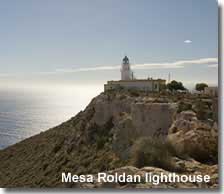 Length : 1.9 km
Estimated completion time : 1:00 hour
Difficulty level : Low
A coastal route and ascent to the Mesa Roldan plateau.
The 18th century Torre Vigia defence tower and a 20th century lighthouse sit on the level table top plateau of Mesa Roldan, though generally the main motive for the hillside trial is the spectacular coastal panorama, with superb views of the Cabo de Gata cliffs and of the coves known as Cala del Plomo, Cala de En Medio and Cala Agua Amarga.
Starting point : The track to the lighthouse is signposted from the ALP-712 from Carboneras, heading in the direction of Agua Amarga.
Parking : Yes.
Via Verde de Lucainena - Agua Amarga
Length : 8.2 km
Estimated completion time : 2:40 hours
Difficulty level : Low
A cultural trail through characteristic park landscapes, with ramblas, plains, and old cortijos.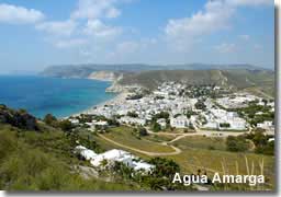
The economic history of the area can be appreciated on this route as it heads out along an old and disused mining railroad, passing through areas of arable lands, both abandoned and modernised.
The railway was used to transport iron from the mountainside village of Lucainena down to the coast at Agua Amarga during the mining era of the region.
Starting point : Access to the route is from the ALP-712 Carboneras to Agua Amarga road, the trail starts approximately 1km before reaching Auga Amarga beside the old farmhouse of Cortijo Los Ventorrillos.
Parking : Yes.
San Pedro - El Plomo - Agua Amarga
Length : 11.1 km
Estimated completion time : 4:30 hours
Difficulty level : Medium to High
A coastal nature walk along the mountainous Cabo de Gata coastline.This trail begins with the ascent of the Cerro Negro, north of the seaside village of Las Negras, a good variety of seabirds can be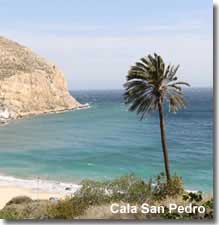 spotted along the craggy cliffs. There are possibilities of observing more bird species as the trail passes one of the best conserved plant landscapes of the park, where the bushes provide a natural shelter for the birds. With successive and attractive coves, the views are of unspoilt beaches, clear transparent waters and striking rock formations, the beaches here can only be reached either on foot or by boat and are often deserted. The route ends in the lovely resort of Agua Amarga. The trail may also be traversed in the opposite direction starting in the coastal village of Agua Amarga.
Starting point : Access to the route from Las Negras is along the road towards Cortijada del Estanquilla across the Barranco de Las Negras.
Access to the route from Auga Amarga is signposted from the ALP-712 on leaving the village to head inland.
Parking : Yes.
La Molata
Length : 1.5 km
Estimated completion time : 1:00 hour
Difficulty level : Medium
A coastal pathway in the colourful valley of Rodalquilar.
Along with the beautiful beaches of Playa del Playazo 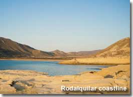 and Cala Cuervo this trail also includes two important historical monuments, Torre de los Alumbres and Castillo de San Ramon, constructed to defend the valley from the barbary pirates of North Africa during the centuries of raids that occurred up and down the coastline.
Not to be missed the ruins of the Alumbres tower are actually located before the start of the trail, along the 2km access road that leads to Playa del Playazo, seen to the right of the road amid an oasis of palm trees.
Starting point : Playa del Playazo is signposted from the ALP-826 approximately 1km outside of Rodalquilar village heading in the direction of Las Negras, the trail begins at the castle of San Ramon at the far left of the beach.
Parking : Yes.
Cortijo del Fraile - Montano - Hornillos
Length : 7.7 km
Estimated completion time : 3:00 hours
Difficulty level : Low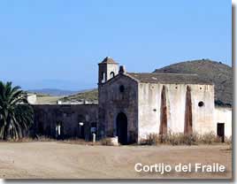
A cultural countryside trail made popular by its well known cortijo. The farmhouse of Cortijo del Fraile owes its notoriety to a tragic crime that occurred here in the 20th century, one that provided the inspiration for Frederico Garcia Lorca to write his acclaimed novel Bodas de Sangre. More recently it is remembered from the Clint Eastwood spaghetti western "The Good, The Bad and The Ugly" the cortijo being used for a location setting for a scene in the much loved movie.
This cortijo is the starting point of the rural trail which offers an insight into the farming heritage of the region and the isolated conditions endured by the local peasant farmers, ancient wells and cisterns exemplify the importance of water collection, which was required for both domestic use and for the livestock. The semi arid plains present contrasting crop terraces with areas of natural vegetation and will be, for many, the main incentive of the path.
Starting point : The route starts at Cortijo del Fraile, which can be reached by vehicle along rough track roads, Cotijo del Fraile is signposted from several villages within the natural park, though closest access is from Albaricoques or Rodalquilar.
Parking : Yes.
Requena 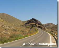
Length : 7.4 km
Estimated completion time : 3:00 hours
Difficulty level : Medium
A nature walk along a volcanic gorge between Rodalquilar and Albaricoques.
The plant life here is abundant thanks to the humidity of the gorge, travelling through landscapes representative of the nature reserve the path offers an opportunity to sample the biodiversity of flora and fauna and witness some of the natural resources which have been utilised throughout the regions long history.
Starting point : The trail starts at El Baranco del Negro which can be reached from the ALP-826 approximately 600m before the turning for Isleta del Morro if heading in a southerly direction from Rodalquilar.
Parking : Yes.
Cerro de Cinto 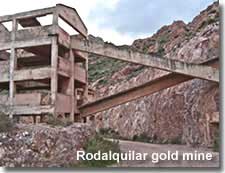 Length : 10.7 km
Estimated completion time : 3:00 hours
Difficulty level : Low
A hillside trail ascending the Cerro del Cinto of Rodalquilar.
A backdrop to the pretty village and scenic valley, Cerro del Cinto offers glorious views of the Rodalquilar landscapes. In the 19th century gold was discovered in the hills, leading to a boom period for the town, the now abandoned gold mining facility, its structure, buildings and tracks, can still be seen and are included in the trail.
Starting point : The climb starts at the gold mining facility which is signposted from Rodalquilar village.
Parking : Yes.
Las Amoladeras 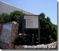 Length : 6.7 km
Estimated completion time : 2:00 hours
Difficulty level : Low
The Amoladeras coastal plain is the setting for this nature trail.
A circular route with an abundance of flora including the prickly pear plant and the agave plant which were introduced to the region in the 19th and 20th centuries respectively, to assist in the regions prosperity. Bird watchers are well rewarded along this route and the trail includes some natural observation points.
Starting point : The pathway begins next to the Almoladeras visitors centre which is signposted from the ALP-202 between Retamar and Pujaire.
Parking : Yes.
Caldera de Majada Redonda 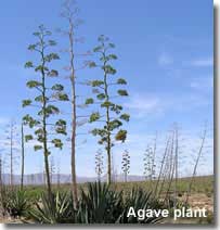
Length : 2.8 km
Estimated completion time : 1:00 hour
Difficulty level : Low
A trail to the Majada Redonda crater.
The volcanic hillsides leading up to the crater offer typical examples of the parks vegetation such as agave plants, fan palms, and almond, carob, and fig trees. The trail enters the inside of the Majada Redonda, an extinct volcanic crater.
Starting point : Descending eastwards from the village of Presillas Bajas, the trail starts at the Rambla de Majada Redonda. The village is reached along a local road from the ALP-826 between Pozo de los Frailes and Escullos.
Parking : Yes, though limited at the start of the trail, further parking is available in Presillas Bajas.
Escullos - El Pozo de los Frailes
Length : 4.7 km
Estimated completion time : 1:50 hours
Difficulty level : Low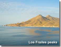
A trail from the coast to the interior of Cabo de Gata.
From the outset the volcanic domes of Los Frailes are always in sight, they represent the highest peaks of the natural park rising to 493m above sea level. Besides the geological attraction of the journey, the flora and fauna are a continuous source of wonderment. At the end of the trail, in El Pozo de los Frailes, there is a 13th century water well which has recently been restored.
Starting point : The crossroad at the entrance point of the small urban centre of Los Escullos marks the starting point of the trail.
Parking : Yes.
Loma Pelada
Length : 9 km
Estimated completion time : 2:30 hours
Difficulty level : Low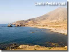
A coastal route rich in the natural patrimony of the region.
Right from the start the amazing volcanic rock formations of Escullos can be enjoyed, as the trial turns inland it passes a bentonite quarry, an example of the exploitation of one of the parks natural resources. Further along the route, and of particular interest, is an area where the remains of volcanic lava flow can be seen on the rocks. The end of the route returns to the coast and some natural observation points which offer marvellous views of the Cabo de Gata shoreline, including the Cala Tomate cove.
Starting point : The trail begins 1km to the south of Escullos reached via the unmade track that runs parallel to the shoreline.
Parking : Yes.
El Pocico - Las Marinas
Length : 6.4 km 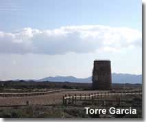
Estimated completion time : 2:00 hours
Difficulty level : Low
A rewarding coastal path combing history and nature.
Representations from the regions cultural history date back to Roman times, while the natural elements of the landscape unveil fossilised remains of marine creatures. The surprising vegetation provides shelter for numerous animal species, and the inner lagoons, abundant with bird life, offer sightings of the migrating Greater Flamingo during certain months of the year.
Starting point : The pathway begins at the Torre Garcia defence tower, beside the Torre Garcia beach, which is signposted from the ALP-202 in between the resort of Retamar and the Amoladeras visitors centre.
Parking : Yes.
Los Genoveses
Length : 2.3 km
Estimated completion time : 1:30 hours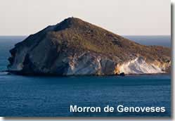
Difficulty level : Low
A beach trail along one of the most symbolic landscapes of the nature reserve.
Sought and enjoyed by tourists from all continents, the natural heritage of the region is much appreciated on this route. The path travels through the beach area from north to south, from the Cerro Ave Maria to the Morron de los Genoveses, two accessible hilltops offering beautiful views of the coast with its volcanic rocks and fossilised formations.
Starting point : Access is from San Jose village, heading south along the ALP-202 towards Monsul and Genoveses. The trail starts close to the mill of Genoveses, beside the crossroad, reached via a right hand turning 300m ahead of the end of the tarmac road.
Parking : Yes.
Vela Blanca 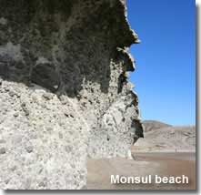
Length : 3.4 km
Estimated completion time : 1:30 hours
Difficulty level : Low
A coastal path including the ascent to the watchtower of Torre Vela Blanca.
The natural discoveries along this trail, both geological and botanical, are always a pleasing surprise for visitors, the route also includes vistas of the renowned beach of Playa Monsul and of the Cala Carbon cove.
Starting point : Access is from San Jose, following the signposted beach road to in the direction of Genoveses and Monsul. The route begins at Casa Monsul approximately 4.5km from San Jose.
The trail can be traversed in the opposite direction, with the alternative starting point signposted from the Cala Raja cove, which lies at the foot of the Torre Vela Blanca precipice. Cala Raja can be reached from the San Miguel de Cabo de Gata ALP-822 coastal highway via a right hand turning signposted for Playa del Coralette close to but before the lighthouse on the Cabo de Gata headland.
Parking : Yes.
Escullos - Isleta del Moro 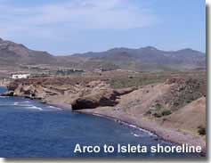 Length : 1.6 km
Estimated completion time : 0:40 hours
Difficulty level : Low
A coastal nature trail.
From Playa del Arco at Escullos to the Mirador of Isleta del Moro, the trail includes examples of the fields of Posidonia growing on the seabed and coastal gorges abundant with a variety of plant species, the sparkling Mediterranean sea is never out of view.
Starting point : Beside Playa del Arco on the northern shores of Escullos, which is signposted from the ALP-826.
Parking : Yes.
The length, estimated completion time, difficulty level, starting point and parking information of each of the 16 signposted walking trails of the Cabo de Gata are sourced and acknowledged from the Junta de Andalucia website.
Bird watching in the natural park ![]()
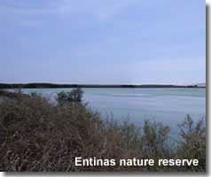
Walking in the Punta Entinas-Sabinar Nature Reserve
The coastline of El Ejido, between Almerimar and Roquetas de Mar, is home to a nature reserve of diverse environments. The terrain includes wide sandy beaches, sand dunes, wetland areas, and incorporates the salt pans of Cerrillos, the different habitats maintain numerous animals and plants, and of particular interest to ornithologists there are a variety of bird species to be spotted.
Signposted Walking Trails Entinas-Sabinar Nature Reserve
There are two signposted walking routes within the natural area of Punta Entinas-Sabinar provided by the Junta de Andalucia, alternatively take the 15km walk along the secluded sandy beach from Almerimar to Roquetas, or vice versa.
Below, the name of each walk is 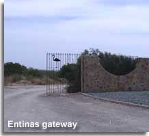 a link to the Junta de Andalucia website which provides further details of each route, in English, and will open in a separate page.
Marismas de Punta Entinas
Length : 6.4 km
Estimated completion time : 1:20 hours
Difficulty level : Medium
A chance to experience the flora and fauna of the marshy wetlands and sand dunes of Punta Entinas.
Starting point : At the south eastern limit of the Almerimar urbanisation development, close to and on the same road as the gateway to the nature reserve.
Salinas de Cerrillos 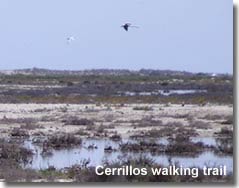
Length : 6 km
Estimated completion time : 1:20 hours
Difficulty level : Medium
A nature trail through the abandoned salt pans of Cerrillos, now a coastal area of shallow pools which attract many resident and migrating birds.
Starting point : At the southern limit of Playa Serena in the resort of Roquetas de Mar, set back a couple of streets from the beach, the trail starts inside the Cerrillos gateway at the end of Avenida de los Cerrillos on the corner with Calle El Condor.
The estimated completion time and difficulty level of each of the signposted walking trails of the Punta Entinas-Sabinar nature reserve are sourced and acknowledged from the Junta de Andalucia website.
The coastline and beaches of the Poniente including Playa Puntas Entinas and Playa Cerrillos ![]()
Bird watching in the Punta Entinas - Sabinar reserve ![]()
Walking Puerta Verde de Roquetas de Mar
Roquetas de Mar is one of the leading beach resorts of the Poniente and in fact of Almeria province. The Puerta Verde, translated as the Green Door, enters the more rural area of Roquetas, with views to the Sierra Gador and the Mediterranean sea, the area spans along the coastline through the conservation area of Las Salinas de San Rafael, the old salt lakes, and runs parallel to the Natural Monument Arrecife Barrera de Posidonia, one of the few remaining Posidonia rich reefs on the Mediterranean coast.
Signposted walking trail Puerto Verde de Roquetas
The area is known as the Cañada Real de la Costa, a natural landscape between the two beach resorts of Roquetas de Mar and Aguadulce, it offers two separate routes, one for walkers and the other for cyclists, both free from traffic. The restored pathways have been constructed from natural or recycled materials in keeping with their surroundings.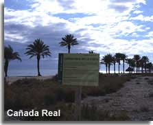
The walking trail is signposted Carril Peatorial, and Carril Bici is the cycle path.
The route is also part of the GR-92, which covers the whole coastline of Almeria, it presents options to extend this short trail and is detailed by destination further down the page.
Length : 1.7 km
Estimated completion time : 0:25 hours
Difficulty level : Low
Starting point : In Roquetas the trail begins at the end of the Paseo del Mar, Playa Las Marinas. In Aguadulce, the route starts at Residencia La Ventilla, by Playa Ventilla, on the outskirts of Aguadulce.
The coastline and beaches of the Poniente including Roquetas de Mar and Aguadulce ![]()
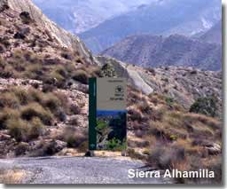
Walking in the Sierra Alhamilla
A distinct walking destination, Sierra Alhamilla rises to 1387m above sea level offering exceptional vistas of the desert landscapes of Tabernas and seascapes of the Mediterranean. A protected natural habitat for bird species, the hillside trails are of great interest to bird watchers.
Signposted walking trails in the Sierra Alhamilla
A section of the much longer GR-140, more precisely, the trail between Tabernas village and Nijar valley, constitutes the main walking route of the Alhamilla, though deviations are often made to incorporate further destinations such as the Baños de Alhamilla, or the villages of Turrillas and Lucainena de las Torres.
Furthermore the Senderos de Historia offer signposted walking trails in the western hills introducing historical sites and archaeological remains.
GR140 - Tabernas to Nijar
The full itinerary of the GR-140 is detailed further down the page, however this part of the trail passes from the 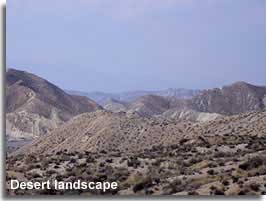 north west of Sierra Alhamilla to the south east of the range and covers a large section of the mountain, including Los Gongoras, the Colativi peak, and Huebro village.
Starting point : The start of this section of the GR trail is signposted from the village of Tabernas on Calle Angustias. A second starting point can be achieved 1.4km from Tabernas, in the rambla below the Punto Moreno bridge, access is from the A-340a between Tabernas village and the Mini Hollywood wild west theme park. Both routes signpost the destination of the first leg of the route as the Colativi peak, the highest point of Sierra Alhamilla, at a distance of 21km and 19.6km respectively.
Sendero Baños de Alfaro
Cerro Alfaro, 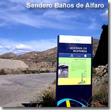 an apparent precipice at the far west of Sierra Alhamilla at 742m above sea level, rises above the Andarax valley with Almeria city and the Mediterranean coastline to the south and the Tabernas desert to the immediate north. The first of two historical trails in the area, the route leads to the Baños de Alfaro situated at the foot of the Alfaro in a desert like landscape. This large site, now abandoned and in ruins, was built at the start of the 19th century and includes the remains of 35 rooms built around a natural spring.
Starting Point: The trail is signposted on N340a that runs parallel to the A-92 Almeria to Guadix highway between the two junctions 382 and 376, the starting point can be reached from either junction.
Sendero Cerro del Fuerte
This second historical trail, the Cerro del Fuerte, traverses the hillside of the same name, which rises to 520m above sea level in the Alhamilla foothills. Recent discoveries, in the form of a collection of burial tombs, have shown evidence of colonies dating back to the start of the Bronze Age.  Today the most noted monument is a boundary wall that was built in Roman times, serving to protect the mining activity in the most accessible parts of the sierra, its perimeter extends for some 650m though now it is mostly in ruins. Within the walled areas ceramic remains have been excavated, with findings dating from between the 4th and 6th century.
Starting Point: As with the first Sendero de Historia it is signposted on N340a that runs parallel to the A-92 Almeria to Guadix highway between the two junctions 382 and 376, the starting point can be reached from either junction.
Lucainena de las Torres pueblo - including local walking trails in the Alhamilla ![]()
Explore the Sierra Alhamilla mountain range ![]()
Explore the Tabernas desert ![]()
Walking in the Sierra de las Estancias
The Estancias mountain range, 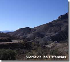 crossing from west to east in the north of the province, contribute to the formation of the northern aspects of the Almanzora region incorporating several of the Almanzora white mountain villages.
Experiencing intense climate conditions throughout the year, plant life is of particular interest with many endemic species that have adapted to their environment. With the seasonal changing of scenery, stunning in its natural splendour, there is plenty of scope for nature walking and hiking with options for exploring the native villages.
Signposted walking trails of Sierra de las Estancias
The Estancias mountains are divided into three mountainous sections, the Sierra de Lucar, peaking at 1722m, with the Sierra de Oria and the Sierra del Saliente both reaching altitudes around the 1400m to 1500m mark.
The primary route through the Estancias is a section of the much longer GR-143. The full itinerary of the 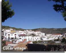 GR-143 is detailed further down the page.
GR-143 Chirivel - Lucar
Length : 54 km
Estimated completion time : 11:30 hours
The GR-143 traverses the Estancias through the Sierra de Oria and the Sierra de Lucar, including the destinations of Chirivel, Oria, Urracal, Somontin and Lucar, before crossing the valley and continuing in the Filabres mountain range.
Starting point :The trail could be picked up in Chirivel heading in the direction of Oria and passing through the Estancias from north to south offering the best views of the Almanzora valley and across to the Sierra de los Filabres.
Explore the Sierra de las Estancias mountain range ![]()
Explore the Almanzora region of Almeria ![]()
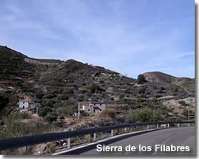
Walking in the Sierra de los Filabres
The largest and most central mountain range in Almeria province incorporating a large part of the Valle de Almanzora, the range also extends into the province of Granada. Towering hillsides and woodland valleys provide natural habitats for much flora and fauna, while the countryside villages, reminiscent of times gone by, reveal the regions cultural history. The sierra is also home to some of the highest peaks in Almeria after the Chullo peak in the Sierra Nevada, in the winter months it is not uncommon to find snow on the mountains.
Walking trails in the Sierra Filabres
Calar Alto - La Tetica de Bacares
Length : 19 km
Estimated completion time : 5:00 hours
A mountain trek from the Calar Alto, the highest peak of the Sierra de los Filabres, traversing the mountain tops and woodland slopes to the second highest peak of the range, the Tetitca de Bacares, 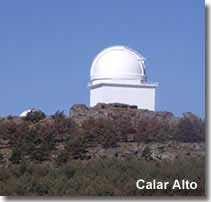 both at over 2000m above sea level. A forest trail and reasonably level cruise, with slight declines, up to the final ascent of the Tetica peak.
Starting point : The route begins at the Calar Alto Observatory which is signposted to the left from the A-339 roadway after reaching the mountain summit. Access to the A-339 is from the village of Gergal which is located along the A-92.
The trail to La Tetica is also signposted, to the right, from the A-339, it can be spotted before reaching the observatory and returned to later on foot.
Itinerary : On reaching and following the sign to Tetica, from the Calar Alto, 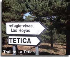 the first section of the trail travels along the mountain ridge including pathways that pass along both the north and south face of the mountain top. The northern face offers forest and valley landscapes with views to the trail destination, the raised Tetica peak, identified by the communications antenna protruding from the summit, and the outlook from the southern face includes the mountain ravines and southern slopes of the Filabres along with far reaching vistas to the Tabernas desert and the Sierra Alhamilla.
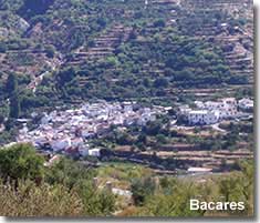
The second section of this trail moves away from the north ridge, through areas of woodlands, and meets the road and direct route to La Tetica de Bacares crossing through a pine forest. In this final section the road begins and continues with an level trek, which, on nearing the crest, gains altitude very quickly with a steep ascent to the summit. Peaking at 2080m above sea level there are remarkable vistas of the surrounding countryside in every direction.
The above trail, its distance, approximate completion time and itinerary, is acknowledged from the Senderos de Almeria website which provides further details of the route, in Spanish, and will open in a separate page.
Las Menas 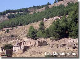
Length : 4.5 km
Estimated completion time : 1:30 hours
A small circular route that navigates through and around the historical ruins of the deserted mining village of Las Menas, situated in a concealed valley of the Almanzora in the Filabres mountain range, close to Seron.
During the late 19th and early 20th centuries the village was highly populated with workers involved in the extraction and transportation of iron from the hillside mines, iron depletion and closure of the mines resulted in the depopulation of the village, and today the setting is home to the remains of the original buildings and mining facilities. 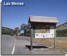 Starting point : The trail is signposted from the main road through the village, next to the camping area, where a roadside information board provides details of the old village layout.
Las Menas is located along the AL-5406, which can be reached from two separate junctions on the A-339 mountain highway that runs from Seron in the Almanzora Valley to Gergal in the southern foothills of the mountain range. This walking trail starts on entry to the village from the first junction if travelling from the direction of Gergal.
The distance and approximate completion time of this trail is acknowledged from the Senderos de Almeria website which provides further details of the route, in Spanish, and will open in a separate page.
Explore the Sierra de los Filabres mountain range ![]()
Explore the Almanzora region of Almeria ![]()
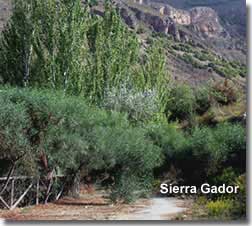
Walking in the Sierra Gador
Located between the Sierra Nevada mountain range and the Mediterranean sea, Sierra Gador, without doubt, offers magnificent possibilities for nature walking, hiking and mountaineering, with summits reaching over 2000m above sea level including the Nuevo Mundo at 2107m, Dos Hermanas at 1991m, the Alto del Castillejo at 1977m and the Pecho Cuchillo at 1974m. There is an extensive network of forest paths with breathtaking scenery, and, in the south, particularly around Berja, the hillsides offer examples 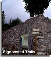 of the rich mining heritage of the region, with remains from the 19th and 20th century iron and silver mining industry.
Signposted Walking Trails of Sierra Gador
The following walking routes of Sierra Gador are detailed on location, at the staring point of each of the routes, where information boards, with maps, chart the routes.
For safety reasons, and due to the mining history of the area, deviating from the signposted trails and pathways is inadvisable.
Dalias - Sierra Gador
PR A-113 Sendero Fuente Alta 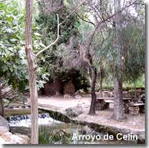
Length : 22 km
Estimated completion time : 6:00 hours
Difficulty level : High
Recommended for experienced walkers, the circular trail travels from Arroyo de Celin through some of the most illustrative places of southern Gador, including Cortijo Clavero, Las Minas del Peñoncillo, Fuente de la Mosca, and Fuente Alta at 1750m above sea level, crossing hillside pine forests and enjoying impressive views to the Mediterranean sea. Fuente Alta can be reach by vehicle on a separate track, which is also detailed on the information placard at the start of both of these routes. For the experienced mountaineer the trail offers the optional ascent, along the PR A-144, to the summit of Sierra Gador, the Nuevo Mundo.
Starting point : The information board, with route and map, is provided at the entrance to the Arroyo de Celin Recreational Area. Celin village can be reached from the A-358 and the Arroyo de Celin is signposted on approach to the village.
Castala - Sierra Gador
The following three trails all start out at the same point, from within the Castala Peri-Urban Park located 5km from Berja town. The Castala recreational area is signposted along the main A-358 road through Berja and the start of the trails are indicated once inside the park.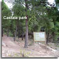
PR A-336 - Minas de Berja
Length : 8.6 km
Estimated completion time : 4:15 hours
Difficulty level : M.I.D.E. 3-2-2-3
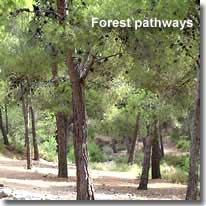
This circular trail, traversing pine forest pathways and passing through the rambla Julvina, incorporates some of the most significant mining remains of the area.
PR A-337 - Sendero de los Lavaderos
Length : 13 km
Estimated completion time : 5:15 hours
Difficulty level : M.I.D.E. 3-2-2-3
A circular route sharing some sections of the previous trail, the main attraction is to visit the old mining installation of El Segundo and follow in the footsteps of the mine workers on the daily trail to and from their work at the mines.
 PR A-145 Castala - Cortijo Clavero
Length : 12.4 km
Estimated completion time : 5:00 hours
Difficulty level : M.I.D.E. 3-2-2-3
A lineal mountain pathway from Castala to Cortijo Clavero, starting with a steep ascent that levels to gentle variances of between 1200m and 1400m above sea level, with vistas of Berja valley and the Poniente coast. Cortijo Clavero, the destination of this trail, is included in the PR A-113 trail of Dalias - Sierra Gador, thus connecting the two areas and extending the walking route options.
Explore the Sierra Gador mountain range ![]()
Walking in the Sierra Maria - Velez Natural Park
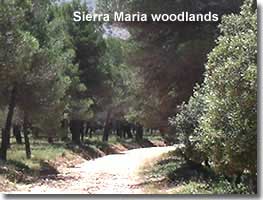
The Natural Park of Sierra Maria is located in the north of Almeria province, a mountainous region with a vast woodland coverage, the park incorporates the mountains of Sierra Maria, Sierra Maimon and Sierra Larga. Offering some very different scenery dependent on the time of year, the landscapes provide a snowy setting in the winter due to the high altitudes of the ranges, whereas springtime is ideal for nature walking and bird spotters will not be disappointed with many birds of prey nesting in the region.
Signposted Walking Trails of Sierra Maria - Velez
There are nine signposted walking routes located within the Natural Park of Sierra Maria - Velez, each documented by the Junta de Andalucia, all offer outstanding seasonal scenery.
The two main visitors centres of the park, the Almacen del Trigo in Velez Blanco, and the Umbria de Maria, just outside of Maria town, both provide free maps pinpointing the starting and finishing points of the walking trails.
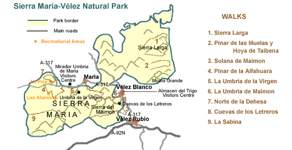
Below, the name of each walk is a link to the Junta de Andalucia website which provides further details of each route, in English, and will open in a separate page.
Sierra Larga
Length : 16.7 km
Estimated completion time : 8:00 hours
Difficulty level : Medium
Starting point: From Velez Blanco, 400m past the cemetery, taking the El Gabar road for approximately 8.5km, then following the forest trail to the right,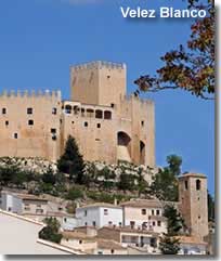 into the valley, for another 3km, a further right turn towards La Hoya leads to the starts of the trail at the pathway to the left.
Pinar de las Muelas y Hoya de Taibenas
Length : 8.3 km
Estimated completion time : 3:00 hours
Difficulty level : Low
Starting point: From Velez Blanco, 400m past the cemetery, taking the road to the right in the direction of Montalviche. The start of the trail is found after approximately 8km by turning towards Las Muelas.
Solana de Maimon
Length : 12.8 km
Estimated completion time : 5:30 hours
Difficulty level : Medium
Includes the Mirador Puerto del Peral
Starting point: From Velez Rubio on the A-317 in the direction of Velez Blanco, turning left at the sign for the restaurant El Molino de La Reina and continuing to the Fuente de la Reina where the path begins.
Pinar de la Alfahuara
Length : 8.3 km
Estimated completion time : 2:00 hours
Difficulty level : Medium
Includes the Mirador Puntal del Morral
Starting point:The trail is found heading from Maria in a westerly direction along the A-317 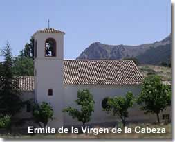 and is signposted from the main road.
La Umbria de la Virgen
Length : 2.9 km
Estimated completion time : 1:40 hours
Difficulty level : Low - Medium
Starting point: The beginning of the trail is located beside the botanical centre and Ermita de la Virgen de la Cabeza chapel, which are signposted from the A-317 roughly 2km to the west of Maria town.
La Umbria del Maimon
Length : 8.9 km
Estimated completion time : 4:30 hours
Difficulty level : Medium
Includes the Mirador Collado de las Arenas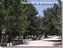
Starting point: The path starts to the left of the main A-317 road just after the first turning for Velez Blanco if heading from Velez Rubio.
Norte de la Dehesa
Length : 5.4 km
Estimated completion time : 2:00 hours
Difficulty level : Low
Includes the Mirador de La Dehesa
Starting point: Heading west from Maria, along the A-317, and continuing straight ahead onto a local road when the main road takes a sharp turn to the right, the beginning of the trail is next to the La Piza recreational area.
Cuevas de los Letreros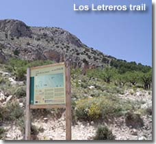
Length : 0.7 km
Estimated completion time : 0:30 hours
Difficulty level : Medium
The walk can be taken at any time, however the destination, the historical caves of Cuevas de los Letreros, adhere to specific visiting times which are detailed at the Pinar del Rey information kiosk.
Starting point: Signposted from the A-317 between Velez Rubio and Velez Blanco, access to the trail is signposted to the left, across from the camping area of Pinar del Rey and the information kiosk, which is on the right hand side of the main road.
La Sabina
Length : 9.8 km
Estimated completion time : 5:00 hours
Difficulty level : Medium
Includes the Mirador Las Sabinas and the Sabina Albar natural monument, a Juniper tree estimated to be several hundred years old.
Starting point: The trail start is reached by following the road that leaves Chirivel to the Cortijada de Mojonar, passing the cortijada the route is signposted on the left hand side.
The estimated completion time and difficulty level of each of the 9 signposted walking trails of the Sierra Maria - Velez natural park are sourced and acknowledged from the Junta de Andalucia website.
Explore the Sierra Maria - Velez natural park ![]()
Walking in the Sierra Nevada / La Alpujarra - Almeria
The Sierra Nevada, 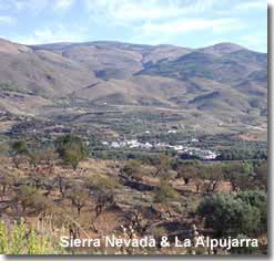 perhaps mostly known for its ski resort in the province of Granada, is also partly situated in the province of Almeria. After the winter snow has melted the mountains are an ideal location for trekking and walking, the high altitudes of the range providing cool clean air. A region of unparalleled natural beauty, it is recognised as both a national park and nature park and is home to many woodland areas, water courses, plants and animals. The valleys in the southern foothills of the Sierra Nevada, which lie between the Nevada mountains and those of the Sierra Gador, are known as the Alpujarras, the serene countryside is dotted with traditional whitewashed villages, a peaceful setting for exploring and nature walking.
Signposted Walking Trails of the Alpujarra - Almeria
The Junta de Andalucia provides two signposted walking routes within the Alpujarra Valley of the Sierra Navada Nature Park in Almeria.
Below, the name of each walk is a link to the Junta de Andalucia website which provides further details of each route, in English, and will open in a separate page. 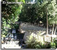
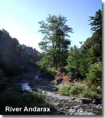
The El Nacimiento Recreational Area of Laujar de Andarax is the setting for the starting point of both of these walking trails and the source of the river Andarax. Laujar de Andarax, a charming hillside village in the Alpujarra of Almeria can be reached from the A-348 either from the village of Fondon or from the exit signposted Laujar de Andarax. The recreational area is singposted Area Recreativo Nacimiento from the A-348a local road that runs through and along the bottom of the village.
Within the recreational area itself, close to the first river bridge, there is a map of the area indicating the starting points of each of the walks.
Aguadero
Length : 14 km
Estimated completion time : 5:30 hours
Difficulty level : M.I.D.E. 2-3-2-3
On the southern slopes of the Sierra Nevada this trail includes rivers, ravines and woodlands.
Starting point : From the Nacimiento recreation area, the trail starts across the river and approximately 1km along the woodland track that runs parallel to the river towards La Fabriquilla.
Monterrey
Length : 7.6 km
Estimated completion time : 3:00 hours
Difficulty level : M.I.D.E. 2-2-3-2
A nature route of streams and woodlands, a variety of tree species can be encountered along this trail, with a chance of observing wild boar and the emblematic Iberian mountain goat that come to the river to drink.
Starting point : The path starts across the highest of the bridges that pass over the river in the El Nacimiento recreational area.
The estimated completion time, difficulty level and starting point of each of the signposted walking trails of the Alpujarra / Sierra Nevada Nature Park, are sourced and acknowledged from the Junta de Andalucia website.
Signposted walking trails of the Sierra Nevada - Almeria
At 2611m above sea level the Chullo Peak is the highest in Almeria and is situated in the Sierra Nevada mountains, close to the border with Granada province, in the Puerta de la Ragua area. 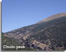
Below, the name of the walk is a link to the topwalks.net website which provides further details of the route, in English, and will open in a separate page.
Chullo Peak
Length : 16 km
Estimated completion time : 5:15 hours
The trail, ascending to the summit of Chullo also traverses gorges, streams and woodland pine forests, from the top of the ridge there are views of the Laguna Seca dry lake, and all encompassing vistas of the Sierra Nevada.
Starting point : The trail is signposted from the Puerta de la Ragua recreational area and ski station, next to the Refugio Albergue, on the border between Almeria and Granada at a height of 2000m above sea level, the centre supplies free basic maps of the area which include this walking route.
The A-337 offers access to Puerta de la Ragua.
Explore the Sierra Nevada mountain range and the Alpujarra valleys of Almeria ![]()
Walking in the Natural Area Gypsum Karst - Sorbas
The 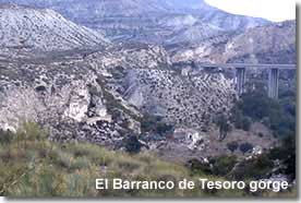 Natural Area Karst en Yesos of Sorbas, close to the Tabernas desert, is one of the best preserved Gypsum Karst sites in the world. A landscape of carbonate rock and cave formations, created over time by geological, environmental and climate conditions that makes for a fascinating walking destination.
The caves, Cuevas de Sorbas, have become a major attraction of the region and the wonders of the Gypsum crystal caves can be experience on a guided tour.
Signposted Walking Trail Karst en Yesos de Sorbas
The walking route, provided by the Junta de Andalucia, offers a terrain like no other. The formation of the landscape is explained, in the form of interesting informational displays, at the visitors centre, Centro de Interpretación Los Yesares, situated in Sorbas village.
Below, the name of the walk is a link to the Junta de Andalucia website which provides further details of the route, in English, and will open in a separate page.
Los Yesares de Sorbas 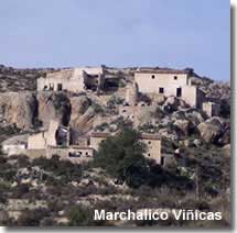
Length : 4.4 km
Estimated completion time : 1:30 hours
Difficulty level : Medium
The trail explores the landscapes of this important gypsum karst site, and offers views of the Barranco del Tesoro gorge before ending by the Rio Aguas river bed.
Starting point :The trail starts in the abandoned hillside village of Marchalico Viñicas, which can be reached via an unmade hillside track from the first roundabout at exit 510 of the AP-7 motorway if heading in the direction of Almeria city. If travelling along the motorway in the opposite direction, access to the track will be from the second roundabout at exit 510.
The estimated completion time, difficulty level and starting point of the Los Yesares de Sorbas walking trail is sourced and acknowledged from the Junta de Andalucia website.
Walking in the Tabernas Desert
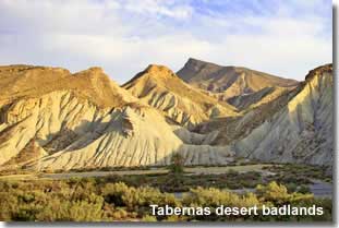
The desert landscapes of Tabernas must surely offer some of the most dramatic scenery in Spain, an area of badlands situated between the Sierra Filabres, in the north, and Sierra Alhamilla, to the south, it is not surprising that the awesome terrain is chosen as a walking destination.
The area has not gone unnoticed by many accredited film directors, its likeness to the desert areas of North America have given the region an unmistakable cinematic history. The landscapes, used as a backdrop for many well known blockbusters, will be well recognised on disclosure of the movies. 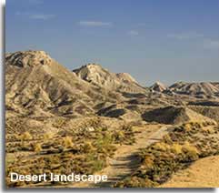
Curious? There are local companies specialising in not only walking, but horse riding treks, 4 x 4 adventures and even camel rides within the desert, pinpointing the precise locations of the movie scenes. Yet, just as important, and in my view even more so, the tour guides do not forget the geological significance of the area and the natural habitats that hosts an unexpected selection of flora and fauna. In my opinion it is well worth taking a guided tour of the area, whether on foot or by any other means, to fully appreciate all that the desert has to offer.
Tabernas desert guided tours and cinema locations ![]()
Walking trails in the Desert of Tabernas
The ramblas of the desert supply the natural walking routes through the desert valleys and ravines. 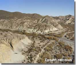
A map of the rambla trails is displayed on an information board in the small car park just before the entrance to the Mini Hollywood Oasys Theme Park.
The rambla trails include:
- Rambla de Tabernas
- PR A269 - Sendero del Desierto
A circular route which also traverses through part of the Rambla de Tabernas as well as the El Cautivo and the Ramblilla de Genaro. - Arroyo Verdelecho
An optional extension from the Sendero del Desierto. - GR140 - Rioja to Tabernas
A small section of the GR-140 signposted walking trail, specifically the route from from Rioja to Tabernas, incorporates most of the Rambla de Tabernas before it climbs to the Sierra Alhamilla.
The ramblas are all interlinking and there are several 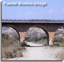 route options available.
Access to the ramblas can achieved via some descending tracks beside three separate bridges. The most central being the Puente de los Callejones, located from the A-92 by taking the turning at exit 376 on to the N-340a in the direction of Tabernas, the bridge is situated just after the junction. Closer to Tabernas, and along the same N-340a road is the Puente Moreno. The third access point, Puente del Cautivo, can be reached from the local road that runs parallel to the main A-92 highway between exits 376 and 382.
Personally, I would take a guided tour of the desert, this is a vast area and an intricate maze where the knowledge of local experts would provide the visitor with a distinct advantage. However for the independent adventurer, 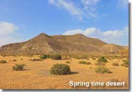 the desert trails can be a highly rewarding experience, though care must be taken and the desert rules should be observed.
The inspiring desert landscapes, of a fragile and easily eroded structure, hold important geological values, they are home to several plant species that not only contribute to the environment but provide an important habitat for the animal and bird life of the area. For these reasons, and for personal safety, the following recommendations should be adhered.
- Keep to the main ramblas and do not deviate from the recommended routes
- Do not enter the ramblas in times of rainfall, flash floods can create a grave risk
- Private vehicles are not allowed in the desert interior
- Camping is not authorised in the desert area
- Removal of any plant, animal or bird species is prohibited
One of the best times to visit the desert is in the spring, when the desert flora is at its prime and the temperatures are not yet at their summertime peak.
Explore the Tabernas desert of Almeria ![]()
Walking in the Valle de Almanzora
The Almanzora valley is situated between two mountain ranges,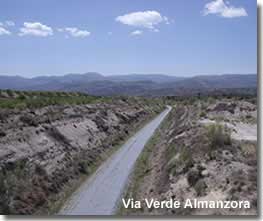 the Sierra de las Estancias and the Sierra de los Filabres, a large part of both are included in the Almanzora region limits. Therefore walking in the Valle de Almanzora can incorporate either of the mountain ranges.
With contrasting scenery, and a great many places of historical and cultural interest amid the whitewashed hillside pueblos, the Almanzora is a recognised hotspot for walking and hiking.
Signposted walking trails of the Almanzora Valley
There are countless local pathways in the Almanzora, including PR and SL routes, signposted from each of the villages. It is my intention to gradually visit each and every town and village in the Almanzora, and in fact the whole of the province, devoting a full page of this website to each, in doing so I will also provide details of the local walking trails and link to them from this page.
Meanwhile the Almanzora has two Via Verdes, the Via Verdes of Spain are a network of walking and cycling pathways that follow the lines of abandoned railway tracks, re-cycled and closed to motor vehicles, they offer an environmentally friendly way to discover the Spanish countryside. The two Via Verdes of the Almanzora are at Seron and Olula del Rio, soon to be joined in one long trail there are now plans in place to extend the route along the Granada to Murcia rail line from the current starting point in Hijate all the way to Zurgena.
A further walking trail through the Almanzora is the GR-143, continuing from the Sierra de las Estancias, it passes through a wide section of the valley before reaching the Filabres village of Laroya within the southern Almanzora limits. 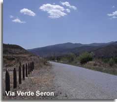
Via Verde Hijate - Seron
Length : 11.8 km
Estimated completion time : 2:20 hours
Difficulty level : Low
Following the route of the old railway through the municipality of Seron including the old disused train station, Estacion de Seron. The trail also passes by the tiny village of Fuencaliente, notable by its pretty church, 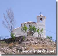 Iglesia de Fuencaliente, perched on a hilltop above the pathway and the Aljibe de Fuencaliente.
The name Fuencaliente is derived from the two Spanish words Fuente and Caliente, meaning fountain and hot, no doubt named after the natural hot water spring around which the remains of an outdoor Arabic bathing area, the Aljibe, is still evident.
The village itself, no more than a few whitewashed farmhouses, nestles on a hillside with remarkable views to the Sierra de los Filabres, 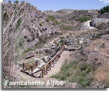 particularly from the panoramic viewing spot that the church provides.
Now as for the Fuencaliente Aljibes, they are signposted from the Via Verde pathway at 600m down a trail off the Via Verde green way, however the indicated trail to the Aljibe ends at 300m with three differing options in direction and no indication of which track to take! Not one to give up easily, especially when there is something of certain historical interest, I followed each option for well over 600m and still found nothing. 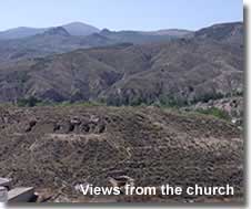 After questioning my sanity I changed tack and headed in the opposite direction to the sign indication only to find what I believe to be the Aljibe situated by the side of the Via Verde pathway at the foot of the village. Furthermore there are are several hollows in the hillside directly in front of the pueblo, seen from the church mirador,
  which I suspect may relate to the mining history of the Almanzora. I have found generally that historical landmarks in Almeria have been well signposted and often with placards of explanation, Fuencaliente being an exception to this rule. All the same this tiny hamlet, with I would imagine less then 30 inhabitants, is a delightful example of a Spanish village that remains unchanged by the passing of time.
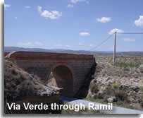
Starting point : The trail begins at the metal bridge between Ramil Alto and Ramil Bajo which are signposted from the A-334 between Seron and Hijate.
Fuencaliente is also signposted from this section of the A-334.
Via Verde Olula del Rio
Length : 1.6 km
Estimated completion time : 0:25 hours
Difficulty level : Low
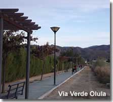
This short trail, recovered and made into an appealing walking and cycling track, runs almost almost parallel to the A-334 along the outer limits of Olula del Rio town.
Starting point : At either end of Olula town beside the A-334.
GR-143 Seron - Laroya
Length : 65km approx.
Estimated completion time : 14:00 hours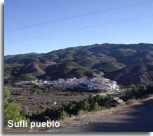 This section of the much longer GR-143, travels from Seron in the Almanzora valley to Laroya in the Sierra Filabres, incorporating the Almanzora villages and towns of Las Menas, Bacares, Sierro, Sufli, Olula del Rio and Macael, an important route acknowledging both the past and the present mining industries of the Almanzora.
Explore the Almanzora region of Almeria ![]()
Explore the Sierra de las Estancias mountain range ![]()
Explore the Sierra de los Filabres mountain range ![]()
Walking the GR, PR and SL trails of Almeria:
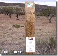
- GR routes - Gran Recorrido - a long journey
- PR routes - Pequeño Recorrido - a small journey
- SL routes - Sendas Locales - local trails
These signposted routes are colour coded, with markers indicating the pathways throughout the course of the trail including any change in direction, along with a white line, red is used for the GR trails, yellow for the PR routes and the SLs are marked in green.
PR and SL Walking Routes of Almeria
The Pequeño Recorridos and Sendas Locales of Almeria are located far and wide across the province, 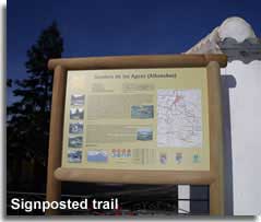 mainly they are signposted from within or on the outskirts of the villages and towns, while all of the paths pass through areas of Almerias memorable landscapes, many include indicative places of cultural interest or historical sites and monuments along the route.
The PR trails usually have a full informational sign detailing the route, whereas the SL trails, which are normally of low difficulty and under 10km, tend to be announced by a simple sign stating the trail destination and distance.
My plan, as I visit each of the villages of Almeria, is to continually add more of these PR and SL walking routes to the pages. I have made a start on the town and village destinations, and the links are provided below.
Local Walking Trails - Towns and Villages
The following featured towns and villages currently include one or more PR, SL, or other local walking trail:
Bedar ![]()
SL-A77 Ruta de la Mineria de Bedar,
SL-A76 Ruta del Agua de Bedar.
Los Gallardos ![]()
PRA-367.
Lucainena de las Torres ![]()
SLA-62, PRA-331, GR-244, Via Verde Lucainena.
Mojacar ![]()
La Mena-Macenas.
The GR Walking Routes of Almeria
The Gran Recorridos of Almeria really do have it all covered, passing from the mountains and valleys to the Mediterranean coastline, including nature reserves,  natural parks, a desert and many picturesque whitewashed Andalucian villages, allowing the visitor to experience local history, architecture, customs and cuisine along with exemplary flora and fauna of the landscapes and their habitats. The villagers are more than welcoming and are very proud to share their heritage, offering an unequalled opportunity to practise the language and interact with the locals within their home communities.
The routes occasionally meet with each other offering alternative options in direction, and most of them continue beyond the province of Almeria. In general these long journeys are broken down into sections, either as individual trails, or taken over several days together to create the ultimate walking holiday.
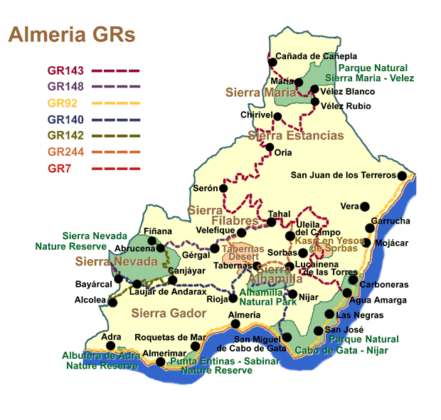
GR-143
Entre Sierras, its name meaning between mountain ranges, this route starts in the far north of the province of Almeria, 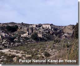 on the border with Granada, and travels down to the Parque Natural Cabo de Gata via three significant mountain ranges. The first, Sierra Maria in the natural park of Maria - Velez, followed by the Sierra de las Estancias and the Sierra de los Filabres, passing through many hillside pueblos and a region known as the Valle de Almanzora. It is the only GR route to include the important Paraje Natural Karst en Yesos landscape of Sorbas, before continuing to the coastal village of Agua Amarga. The trail could be elongated even further by connecting to the coastline route in Agua Amarga, or alternatively a by taking an earlier detour in the village of Tahal, to the Sierra Nevada Nature Park on the GR-148, again the route could be extended from there, with a choice of destinations.
Sierra Maria Velez Natural Park - Chirivel - Urracal - Somontin - Lucar - Seron - Bacares - Olula del Rio - Macael - Laroya - Reul Alto - Tahal - Alcudia de Monteagud - Benitagla - Benizalon - Santuario de Monteagud - El Marchal - El Chive - Los Martinez - Paraje Natural Karst en Yesos de Sorbas - Polopos 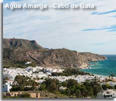 - Argamason - Agua Amarga
Sierra Maria - Velez natural park ![]()
Sierra de las Estancias mountain range ![]()
Sierra de los Filabres mountain range ![]()
The Almanzora region of Almeria ![]()
Sorbas Caves in the Karst en Yesos natural park ![]()
The Cabo de Gata natural park ![]()
GR-148
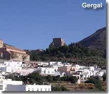
Abrucena - Tahal, from the village of Albrucena in the north of the Sierra Nevada nature park, to the centrally situated Tahal in the Sierra de los Filabres, this route connects the GR-142 to the GR-143 so it can obviously be expanded upon, once again with multiple alternatives in differing directions.
Abrucena - Gergal - Velefique - Tahal
Sierra Nevada and the nature park ![]()
Sierra de los Filabres mountain range ![]()
GR-92
Sendero del Mediterraneo, a coastal route that starts in the province of Malaga 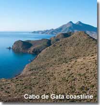 advancing along the Andalucian shoreline to include the full length of the coastline of Almeria from Adra to San Juan de los Terreros. An ideal walk for bird spotters as it not only incorporates the two nature reserves of Albufera and Punta Entinas, but accommodates the Salinas de Cabo de Gata, the most renowned bird watching location in Almeria.
Adra - Balanegra - Almerimar - Roquetas de Mar - Aguadulce - Almería - Costa Cabana - Retamar - 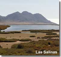 Cabo de Gata - Fabriquilla - San Jose - Los Escullos - Rodalquilar - Las Negras - Agua Amarga - Carboneras - Mojacar - Garrucha - Villaricos - San Juan de los Terreros
An introduction to the beaches and coastline of Almeria ![]()
Bird watching in Almeria including the Salinas de Cabo de Gata and the Poniente nature reserves ![]()
GR-140
Puerto de la Ragua - Cabo de Gata, from nature park to natural park, 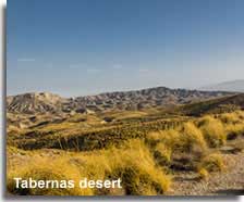 over mountains and across valleys, the trail begins in Puerto de la Ragua in the Sierra Nevada and descends through the lush valleys of the Alpujarras before arriving, in complete scenic contrast, at the ramblas of the Tabernas desert. From here the trails climbs over the arid Sierra Alhamilla via its highest mountain peak and descends into the Nijar valley before heading to the coastline and the Parque Natural Cabo de Gata.
Puerta de la Ragua – Bayarcal – Paterna del Rio - Laujar de Andarax – Fondon – Almocitas – Padules – Canjayar - Barriada de Alcora – Instincion - Bentarique - Terque – Alhabia - Santa Fe de Mondujar – Gador – La Rioja - Tabernas – 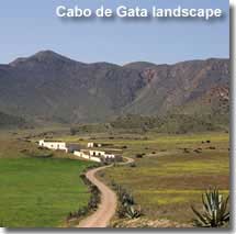 Cortijo Los Gongora (Sierra Alhamilla) - Colativi peak (Sierra Alhamilla) – Huebro - Nijar – Cabo de Gata
Sierra Nevada nature park and Las Alpujarras ![]()
Sierra Alhamilla mountain range ![]()
The Cabo de Gata natural park ![]()
GR-142
Senda Alpujarras, traversing the Alpujarra valleys of Andalucia,  starting in Lanjaron in Granada and extending into Almeria through the Sierra Nevada nature park, from Alcolea in the Alpujarra Almeriense to the village of Fiñana on the northern slopes of the Sierra Nevada. Opportunities to lengthen the route are available.
Alcolea - Laujar de Andarax - Almocita - Fondon - Padules - Canjayar - Ohanes - Abrucena - Fiñana
Sierra Nevada nature park and Las Alpujarras ![]()
GR-244
Senderos de los Pueblos Interior, where the southern slopes of the Sierra 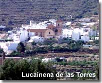 Filabres and the northern foothills of the Sierra Alhamilla meet the Tabernas desert they form a natural loop of inner pueblos, the setting for this route. The trail visits each of the villages, connecting them on a circular path which starts and ends in the whitewashed pueblo of Uleila del Campo.
Uleila del Campo – Santuario de Monteagud - Benizaln - Benitaglas - Alcudia de Monteagud – Tahal – Senes – Velefique - Castro de Filabres – Tabernas – Lucainena de las Torres – Uleila del Campo
Lucainena de las Torres village ![]()
GR-7
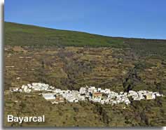
Sendero Andaluz, Cadiz - Granada, a momentous journey through Andalucia, popping into Almeria for just a brief spell, in the Sierra Nevada nature park, where the path runs from Bayarcal to Puerta de la Ragua before returning to the province of Granada. In Almeria the trail links to the GR-140 presenting the option to remain in the province and pursue the trails in Almeria.
Puerta de la Ragua - Sierra Nevada nature park ![]()
General precautions
Important recommendations when walking in the natural landscapes of Almeria:
- The time of year and weather conditions should be considered in preparing for any walking trail, there is little or no shade available on several of the walking routes and summertime temperatures in Almeria can often exceed 40ºC, the high altitudes of the mountains provide cooler conditions than the lower valleys and plains, though in the winter many of the slopes and peaks are snow covered, and ice on mountain roads can prove to be hazardous.
- Many routes are rural, hence it is sensible to take essential supplies including plenty of water.
- Before travelling always advise someone of the intended route.
- Apply the route difficulty level to the relevant experience and fitness of the walker.
- For safety reasons do not wander from the signposted trails and designated pathways.
- Respect the countryside, the leave it as you would expect to find it rule applies.
- Not all routes are circular, therefore it is wise to plan for the return journey at the end of the trail.


