Cabo de Gata Natural Park Guide
Cabo de Gata - Nijar - Almeria - Spain 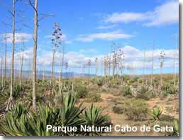
Parque Natural Cabo de Gata extends approximately five hundred square kilometres and includes one hundred and twenty square kilometres of the sea as a marine reserve. An area of special protection, the park is home to a wealth of wildlife and many rare plants that are native to the region.
The demand for rural tourism and destinations offering ecological values has increased in recent years. 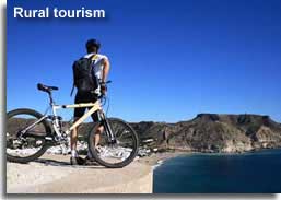 The Natural Park of the Cabo de Gata is such a place, in an away from it all location ideal for walking, cycling, horse riding, mountain biking and 4X4 excursions, the scenery is spectacular and there are numerous places of interest and traditional villages to be explored. For bird watching, the protected wet lands provide a fantastic array of species to be sighted. Underwater, the coral reefs and colourful marine life invite divers and snorkellers while above the water activities change to sailing, windsurfing and kitesurfing, sea kayak and fishing. The beaches of the natural park
 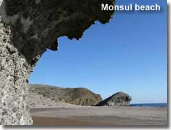 are some of the most stunning in Spain, they offer a mix of easily accessible family beaches to out of the way idyllic hideaways.
Quick links - Cabo de Gata Natural Park Guide:
- Places to visit - Exploring Cabo de Gata
- History and culture - castles - towers - windmills - Pozo de los Frailes waterwheel and well
- Rodalquilar gold mining - mining and minerals
- Cabo de Gata fishing villages - including San Miguel and Las Salinas de Cabo de Gata - San Jose - Isleta del Moro - Las Negras - Agua Amarga
- Cinema locations - Cortijo del Fraile - Albaricoques
- Flora and fauna of Cabo de Gata
- Fiestas of Cabo de Gata
- Property - Cabo de Gata
- Outdoor activities in Cabo de Gata
- Cabo de Gata Natural Park Map - how to arrive
- Tourist Information centres and kiosks including the park visitors centre
The beaches of the Cabo de Gata are deserving of and detailed in their own separate page.
The Beaches of the Cabo de Gata Natural Park ![]()
Choose Cabo de Gata for natural parks in Spain
An unspoilt destination for outdoor activities in an area of natural beauty rich in culture and local history.
EXPLORING - Cabo de Gata
From volcanic beginnings, the landscapes of the natural park have evolved into a region of hills and mountains, gorges, ravines, and arid plains, 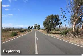 with a dramatic rocky coastline hiding remote and unspoilt beaches and coves. The main roads through the park offer access to the villages of the park, both coastal and inland, however it must be noted that many rural areas and several beaches and coves can only be reached by tracks and sometimes only on foot. The park provides many signposted walking trails from which to appreciate the best of the landscapes.
Cabo de Gata offers the visitor countless options for day trips and excursions and provides a first class destination for rural holidays.
Climate
A place to enjoy outdoor life, Cabo de Gata receives more than three thousand hours of sun each year with very little rain fall and has an average year round temperature of about twenty degrees, though July and August can see temperature above forty degrees. 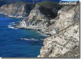
Coastline
The park was established in 1987, it has one of the best preserved coastlines in Europe with management and surveillance in place to ensure protection and proper use of the resources. The shoreline was formed over millions of years, created through periods of volcanic activity and shaped over time by the actions of the wind and the sea.
The coastline of Los Escullos, a raised plateau of 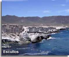 fossilised dune formations, offers a prime example of the effects that the external forces of nature can produce, erosion has occurred here over an extensive time frame resulting in the extraordinary rock features that can be seen today at the waters edge. It is possible to walk across these rocks, but take great care, especially at the shoreline.
Los Escullos is situated between the fishing villages of Isleta del Moro and San Jose and can be reached from the ALP-826, it is also home to the the Castillo San Felipe, a 17th century castle built to protect the region from invading Barbary pirates.
Beaches
The beautiful beaches of the Cabo de Gata warrant special attention and are therefore detailed in a dedicated separate page.
The Beaches of the Cabo de Gata Natural Park ![]()
PLACES TO VISIT - Cabo de Gata
Recommended places to visit are the Miradors of Cabo de Gata, special places of observation located in different areas of the natural park, nearly all accessible by road, they tend to be situated in an elevated position offering supreme vistas of characteristic park landscapes and seascapes.
- mirador - viewing spot
- punta - tip, point
- torre - watchtower
- faro - lighthouse
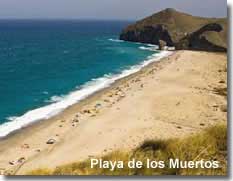 Mirador de los Muertos
A vantage point above one of the largest beaches of the natural park, Playa de los Muertos, the magnificent views are of the beautiful white beach, the clear aquamarine sea, and the dramatic coastal cliffs, inland there are views towards the Sierra Cabrera. The mirador is situated along the ALP-712 road from Carboneras heading towards Agua Amarga.
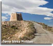
Mesa Roldan
Mesa means table in Spanish, appropriate for this flat topped mountain which lies along the coastline just south of Carboneras. The horizontal peak is home to the 18th century watchtower of Torre Vigia de Mesa Roldan and a lighthouse. The Mesa Roldan signposted walking trail provides access to the top of the plateau from where there are superb view of the cliffs, the fishing village of Agua Amarga, and the coves of Cala de Enmedio and Cala del Plomo. In October 2015 Mesa Roldan was the filming location for a scene in the internationally popular American fantasy drama Game of Thrones. 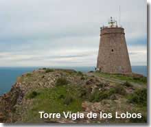
Walking trails of the Cabo de Gata ![]()
Torre Vigia de los Lobos
Situated above Punta Polacra, the 18th century Torre Vigia watchtower was adapted as a lighthouse in 1991 and is said to be the highest lighthouse in Spain, making an ideal spot to enjoy the panoramic views of the coastline. It is reached from the ALP-826 just before the village of Rodalquilar, if heading in a southerly direction, and by taking the left turn at the sign for Torre de los Lobos, Cala Carnaje and Punto de Observacion. 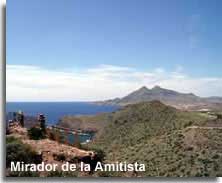
Mirador de la Amitista
A special viewing point located along the ALP-826 after leaving the valley of Rodalquiler heading south, access is directly off the main coast road. A beautiful spot with far reaching outlooks which include the two highest peaks of the park.
Mirador de la Isleta del Moro
This mirador, 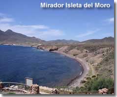 in the small fishing village of Isleta del Moro, offers amazing views of the southern aspects of the coastline towards Escullos, including the bays between the two areas and the peaks of Los Frailes. The mirador is located and signposted from the village which can be reached along the ALP-826.
Torre de Vela Blanca
This 18th century watchtower is situated on the highest coastal outlook point on the southern tip of the cape, and can only be reached on foot. Access from the south can be achieved from the ALP-822 from San Miguel de Cabo de Gata heading towards the lighthouse and taking the left hand turning singposted for Playa Coralette after the climb around the cliffs, or alternatively via the Vela Blanca signposted walking trail which begins along the eastern coastline.
Mirador de la Sirenas
Situated beside the lighthouse at the southern most point of the Cabo de Gata. 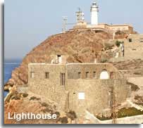 This popular viewing spot offers the most striking views out over the cliffs and down to the rock formations known as
 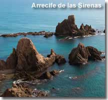 Arrecife de las Sirenas - Sirenas Reef. These volcanic rocks are not only an impressive sight but are a destination for kayak, canoe and snorkelling trips.
The route to the lighthouse and mirador, along the ALP-822, is one that winds its way up, around, and down the headland of the Sierra de Cabo de Gata, this is one of those cliff roads that, in my travels around Almeria, I have come to dread, but also know that they usually lead to rewarding destinations. This particular road has an extra chill factor, 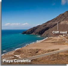 right at the top, just as it approaches a section of bends, it narrows to the width of one car only, um, interesting. What to do? Well, I had to continue as there was no room to turn around, so my only option was to beep my horn at each bend to warn oncoming traffic of my presence, and luckily, even though it was a weekend, the road was quiet and I managed to negotiate this small section without meeting any oncoming traffic.
I should mention that the road ends at the lighthouse, the only way back is along the same route.
I do have to say that 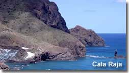 before reaching the lighthouse it is worth taking a detour along the left hand turning signposted for Playa Coralette, even if you don't want to go to the beach. The track road ultimately leads to Torre de Vela Blanca but before hand it offers some fantastic views of the coastline, including Playa Coralette, the white rocks of Cala Raja and
  some interesting rock formations and caves.
Mirador de Las Amoladeras
Located in the Rambla de las Amoladeras and included in the itinerary on the signposted nature walk that begins at the Amoladeras visitors centre, this special viewing spot allows observation of the parks wildlife and an insight into the interesting plant species, including the parks finest examples of jujube groves.
Walking trails of the Cabo de Gata ![]()
Mountains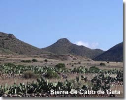
- cerro - hill
- caldera -crater
- sierra - mountain range
The local mountain range, Sierra de Cabo de Gata, is one of the most unusual volcanic complexes in Europe and the largest volcanic feature in South Eastern Spain. It was initially created from a collision between African and European plates, and is the small visible part of a huge magmatic area that occupies much of the bed of the Alboran sea, where eruptions in the mountain range go back roughly six to sixteen million years. Geological history has left behind an intense landscape that really has to be seen to be fully 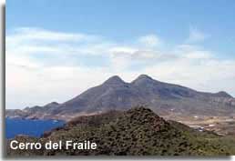 appreciated.
The highest volcanic peak is Cerro del Fraile at 493m above sea level, just south and inland of Los Escullos. La Caldera de Majada Redonda, a volcanic crater, is located close to the small, mostly uninhabited, town of Prescillas Bajas, it is possible to walk to the inside of the volcanic crater and there is a signposted walking trail that includes this experience.
The mountainous countryside can be explored via designated tracks ideal for nature walking, hiking, and mountain biking. The signposted trails of the park are detailed at the Amoladeras Visitors Centre.
HISTORY & CULTURE - Cabo de Gata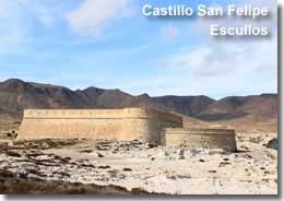
Culture and local history is well represented throughout the natural park, adding an extra dimension to this unequalled destination.
- castillo - castle
- torre - watchtower
- molino - windmill
- aljibe - water cistern
- pozo - well
- noria - waterwheel
The history of this region dates back as early as Neolithic times and over the centuries that followed the region has been home to many different cultures, each of which has left it mark on the territory. Remnants from the Roman epoch, a people who engaged in the full diversity of livelihoods that the area had to offer including livestock breeding, farming, fishing and mining, still endure. The Muslims followed the Romans and continued to improve agricultural techniques developing irrigation systems and 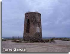 leaving behind the remains of their waterwheels along with the defence castles that were built to protect their lands against invading armies. After the Christian conquest many watchtowers were raised in strategic positions along the coastline, to offer protection against attacks from the pirates of North Africa.
Castles and Watchtowers
Many examples of castles and watchtowers can still be seen throughout the park, they include the Torre Garcia watchtower on the southern coast and the Castillo San Ramon castle located besides the Playazo 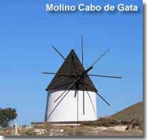 beach in Rodalquilar valley.
Windmills
The old windmills, scattered through the Cabo de Gata countryside, were of extreme importance to local inhabitants, they offer a reminder of the lifestyles of the villagers whose diets were based largely on cereals.
Water Cisterns
Derived from Roman technology, these water storage tanks played an important role in the lives of the locals, and were used for both domestic purposes and farming. 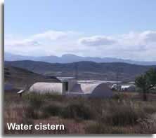 The shortage of water in the area served to make them an essential part of every day living, there are numerous examples to be seen throughout the region.
Wells and WaterWheels
Linked to the water related culture of the region, the waterwheels were constructed from local resources and utilised 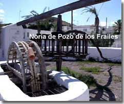 mules or donkeys as the labour source for raising the water from the wells. The last working well to use this wheel method was Noria del Pozo de los Frailes, halted in 1983, it has now been restored providing an excellent historical example.
Pozo de los Frailes
A very pretty and traditional village, proud of its heritage, with its aforementioned water well and a windmill. It is located on the ALP-202 on the direct route to San Jose, many travellers make a worthwhile stop here before continuing down to San Jose fishing village.
Fernan Perez
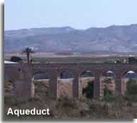
A centrally located village, in the foothills of La Serrata, located along the ALP-208 between Camperhermoso and Las Negras, with a right hand turning towards Albaricoques. 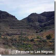 The landscape offers typical historical remains, an old windmill, and a crumbling 20th century Aqueduct.
On my visit here, one Sunday morning in June, it was impossible not to notice the number of groups of cyclist that were either taking the Campohermoso to Albaricoques route or the 17km trip from Campohermoso to Las Negras, both very mountainous stretches, I wished them good luck as I got back into my car for the drive to Las Negras and breakfast at a seafront cafe.
I must mention here that the drive down to Las Negras really is quite exceptional, the mountain road passes through some astonishing scenery, including the village of La Hortichuelas, as it heads towards 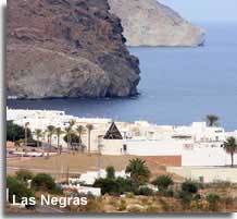 the coast and Las Negras nestled at the foot of the volcanic black hill of Cerro Negro. There were many points that I was in awe of the landscape and I can understand the reasoning of the cyclists enthusiasm to travel this route.
GOLD MINING - Rodalquilar
Mining culture - mineral resources
The region was once affluent in numerous sources of rock minerals, the accumulation of which took place during the volcanic formation of the area. Mined since ancient times, evidence of primitive mining tools have been discovered at Barronel and Rodalquilar and over the years copper, alum, lead, zinc, silver and gold have all been removed from the area, and including, more recently, the mining of gypsum and bentonite.
To best appreciate the mining culture of Cabo de Gata a visit to Roadalquilar is a priority.
Rodalquilar and the Gold Mines
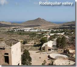
Located along the ALP-826 from Las Negras, Rodalquilar village is set in a colourful gold and green valley against a backdrop of volcanic hills. This once small mining settlement has its own special history, in the story of the Rodalquilar gold rush, brought about when gold was discovered in the hills at the end of the 19th century. 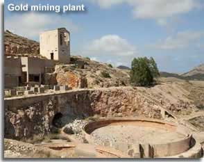 The first profits from the gold mines were shown by the Dorr mining plant, the mine operated between 1931 and 1936, its closure caused by the start of the civil war. A few years later the State took control of the mines, a new company was formed, and rich gold deposits were found in the Cerro del Cinto, leading to the opening of the Denver mine in 1956. This era was a boom period for the village and as the population surged much needed facilities, such as schools, medical services, shops, and even a social club, became available for the first time. Ten years later however, after miscalculations in the productivity of the mines, deposits became depleted and in 1967 the facility was closed. Just as quickly as the community had grown the village then became almost deserted. Gone but not forgotten, the fascinating archaeological heritage still resides and the old mining facilities can be visited. The tourist centre, La Casa de los Volcanes, houses an exhibition room dedicated to the gold mining history, and
 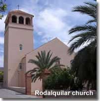 there is also a signposted walking trail, Cerro de Cinto, which includes the highlights of this area.
Walking trails of the Cabo de Gata ![]()
Nowadays the village remains traditional and tranquil and caters to the few tourist that are lucky enough to encounter this special destination. The tourist information centre is located in the village centre, across from the church, and close to the botanical garden centre. There are some quaint looking eating establishments to help complete a lovey day out. 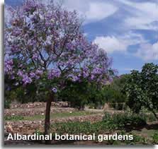 The Albardinal Botanical Garden Centre, to which entry is free, specialises in plant life from the semi arid areas of East Andalucia, with an abundance of well kept displays to stroll around and admire. The garden centre is twinned with the El Cornical Centro Fitoturistico, a display concerning the future conservation of the landscape, though the information is only available in Spanish. The Albardinal and El Cornical are open from June to September from 10am until 1pm then in the evenings from
  6pm until 9pm including weekends but are closed on a Monday. Both the garden centre, Jardin Botanico, and the gold mine facility, Minas de Oro, are signposted, in opposite directions, on entry to the village from the ALP-826.
This is a very highly recommended trip out, and I really enjoyed spending time here, there is so much to see and experience. In addition to the attractions of the village, 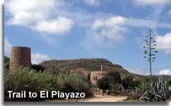 the pretty valley, leading to the beach area of Rodalquilar, is also a must see in my opinion. The track road to the beach in itself is an appealing enticement, set within the valley and lined with symbolic park scenery such as
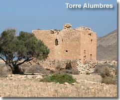
 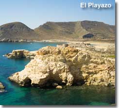 palm trees and agave plants, the trail passes the ruins of the 16th century Torre de los Alumbres and a pretty waterwheel and tower. The approach to the beach is equally lovely, with the 18th century Castillo de San Ramon residing in a prime position overlooking the playa, a reminder of the times when protection of the areas resources and citizens against the North African Pirates was a necessity. Access to the valley track and ultimately the beach is just before Rodalquilar village, if coming from Las Negras, via a left hand turning signposted for Playa Playazo.
FISHING VILLAGES - Cabo de Gata
Fishing in Cabo de Gata is the same as it was years ago, inshore coastal fishing using traditional skills, the boats are small enough to bank on the shore 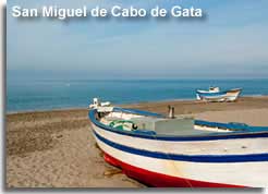 at the end of the day. The declaration of a maritime mile within the parks protective limits prevents larger industrial boats from exhausting the waters and aids in the preservation of the seabed, reefs, plant life and sea life.
The coastal villages of Las Negras, Auga Amarga, La Isleta del Morro, San Jose, and San Miguel de Cabo de Gata are all fine examples of typical fishing villages with their own beaches, each presenting a supreme destinations for rural holidays and offering a central base from which to explore Cabo de Gata, as well as options for day trips. 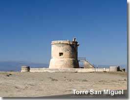
Choose Cabo de Gata for San Miguel
San Miguel is the main village on the southern coastline, it forms the gateway to the attractions of the Cabo de Gata if heading from Almeria city. It has the longest stretch of beach in the natural park which is recognised by the presence of many colourful fishing boats. The landscape between San Miguel village and the southern most tip of the Cabo de Gata is dominated by the Las Salinas salt lakes and a well photographed old church.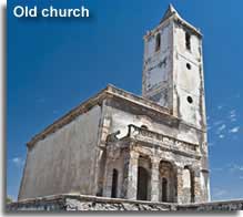
At the time of my first visit to San Miguel, June 2011, the old church was surrounded by scaffolding, I hoped that was for restoration purposes, but it could have been in place to prevent the building from falling down! 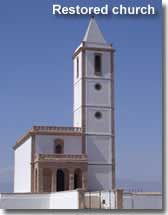 January 2012, on a further visit to the San Miguel area, I can confirm that the church building is certainly being restored, work is still ongoing and the structure is looking much more solid now.
August 2012. Much work has been done and the old church must be almost if not complete, looking quite splendid and true to the style of the original.
Las Salinas de Cabo de Gata
Las Salinas de Cabo de Gata saltwater lagoons run parallel to the beach at San Miguel, exploited since Roman times, the salt pans are still in operation today. Beside their salt production, the marshy habitats provide a feeding ground for many birds species. 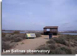 The bird life can be observed from the special viewing points that are signposted from the main coastal highway, there is also a walking and cycling trail, closed to cars, that runs alongside the water pools and around their perimeter.
The key to the biological welfare of the salt marshes, including the continuity of a food source for the birds, is keeping the water levels relatively stable all year round. Their sea level location means that prevailing westerly winds drive water straight across them, if this is not enough, then water is pumped or transported in, especially during the spring and summer months when the arid conditions would normally dry out the area.
Autumn is the season for harvesting the salt, 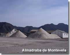 this is done at the small town of Almadraba de Montevela, located just after the old church, where huge heaps of salt can be seen at this time of year and throughout the winter months.
Bird watching in Las Salinas de Cabo de Gata ![]()
Continuing along the San Miguel coast road leads to the previously detailed lighthouse and Mirador on the Cabo de Gata headland, this is where the road ends, access to San Jose, the closest village on the eastern shores, by vehicle, is achieved by returning along the same road and taking the inland route.
Choose Cabo de Gata for San Jose
San Jose
The main tourist resort in the park and home to its only marina and port. A quaint fishing 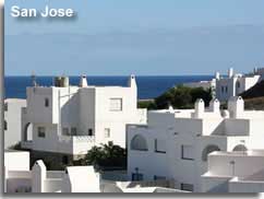 village that still manages to retain its charms of old with white village houses and narrow streets. The lovely beach areas are sandy and shallow, there are plenty of opportunities for diving, snorkelling and sailing. Every amenity is available from this village, shops, bars and restaurants, and all types of accommodation. The information centre, on the main road, is the place to visit to arrange guided walking, cycling and 4x4 trips, including, in the summer months, the Senderismo Nocturno, an evening walk and star gazing experience at the alluring Playa Genoveses.
Horse riding is available for exploring the area from Hotel Cotijo El Sortillo, an 18th century ranch house, converted to a 4 star hotel, just outside of the village of San Jose.
Access to the beaches of Genoveses and Monsul, two of the most visited of the hidden beaches of Cabo de Gata, is from San Jose village centre, Centro Urbano, where the trail is clearly singposted.
Choose Cabo de Gata for Isleta del Moro
La Isleta del Moro
A lovely little village, named after the 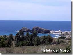 island rock formations that lie at its headland. Access to the village is signposted from the ALP-826.
When approaching Isleta from the north the views towards the coastline really are quite something. The main beach area is disguised by an oasis of palm trees and the preview to the village and its characteristic landscape will definitely make you want to stop and visit.
The village is very low key and traditional, with the popular beach area on one side, and on the other, a water sports centre. The scattering of narrow streets have a couple of bars and fish restaurants and the main road leads up to the mirador and information centre. 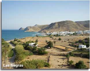
Choose Cabo de Gata for Las Negras
Las Negras
Within the heart of the protected natural area, hidden away among the giant mountains of the Sierra de Cabo de Gata and named after the Cerro Negro, the black mountain, which dominates the landscape to the north, lies Las Negras. A quaint town with a beach of both sand and pebbles and a seafront promenade, there is a lovely selection of cafes and bars close to the beach and a few shops and boutiques. The area between Las Negras and Agua Amarga is the most secluded stretch of the coastline and there is no direct road for vehicles along its length, however the mountainous landscapes can be traversed via the San Pedro - El Plomo - Agua Amarga marked walking track. 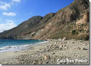 The route includes access to the isolated coves of Cala San Pedro, Cala del Plomo and Cala de Enmedio, some of the most seducing beach areas within the natural park, they can only be experience either on foot or by boat making for some extremely rewarding destinations in both achievement and attraction.
Walking trails of the Cabo de Gata ![]()
Las Negras has opportunities for diving, hiking, mountain biking, 4x4 excursions, kayak, boat trips and boat hire, or simply relaxing within truly beautiful surroundings.
There is something about Las Negras which I find hard to describe, it doesn't have the best beach, and is not the most popular village destination within the park for many a tourist. 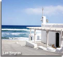 Yet it is tucked away in its own little world, I am happy to wander the streets behind the promenade, with its marvel of cafes and bars, and small selection of shops and clothing boutiques, and of course sample a tapa or two while watching the world go by. Perhaps its the scenery en route to the destination that offers an air of something different, I cannot pinpoint its ultimate draw, maybe its the atmosphere, to a degree it is somewhat hip as travellers set off on their adventures to the secluded beaches and coves to the north of the village. Whatever the attraction is to me I can only recommend a visit to this very welcoming rural destination so that you can experience it for yourself.
Choose Cabo de Gata for Agua Amarga
Agua Amarga
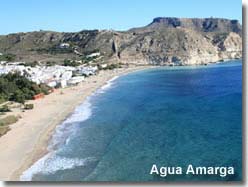
The northern most coastal village on the east side of Cabo de Gata, the whitewash houses typical of the Andalucian village image. Now catering to tourism, especially in the summer months, there are several bars, cafes, restaurants, and shops. The lovely sandy beach is lapped by turquoise waters and enclosed in a wide bay between two cliffs. 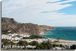
To the south of the village is the walking route to Las Negras and the hidden beaches and coves in between the two villages, to the north is the Mesa Roldan peak. There is a diving and catamaran centre for water sports and naturally hiking and mountain biking are a popular pastime. In the main though Agua Amarga is an away from it all destination, a place to relax by the sea and let time slip by, or while away the hours enjoying the fare from one of the delightful beach side restaurants.
CINEMA LOCATIONS - Cabo de Gata

The unique landscapes of Cabo de Gata have served to create magnificent settings and backdrops to numerous cinematic and audio projects, from commercials and music videos to short films and Hollywood movies, some of the most famous include:
- Lawrence of Arabia - directed by David Lean, starring Peter O'Toole, Alec Guinness, and Anthony Quinn.
- Indian Jones and the Last Crusade - directed by Steven Spielberg, starring Harrison Ford.
- Talk to Her - directed by Pedro Almodovar, starring Javier Camara, Dario Grandinetti, Leonor Watling, Geraldine Chaplin, and Rosario Flores.
- The Reckoning - directed by Paul McGuigan, starring Paul Bettany and Willem Dafoe.
- El Cid - directed by Anthony Mann, starring Charlton Heston and Sophia Loren.
- The Adventures of Baron Munchausen - directed by Terry Gilliam, starring John Neville, Eric Idle, Oliver Reed, Sarah Polley and Sting.
- For a Few Dollars More - directed by Sergio Leone, starring Clint Eastwood and Lee Van Cleef.
Los Albaricoques
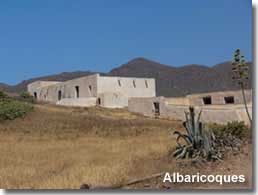
Los Albaricoques, traditional village and movie location.
The cultural history of this remote village lies in its architecture and landscape, a hamlet surrounded by cactus and prickly pear plants, the houses are terraced with thick whitewashed walls and low flat roofs. Los Albaricoques has been utilised as a film location for western movie backdrops and the village streets were used as the set for the Mexican village of Aguas Calientes in the renowned 1965 spaghetti western For a Few Dollars More, 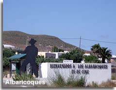 the second movie in the famous series directed by Sergio Leone and starring Lee Van Cleef and Clint Eastwood.
The approach to the village is signalled by the universal image of a western gunslinger, there is an information board on access to the village ![]() and 5 further placards with movie location details, in several languages, throughout the village. Even the street names have relevance, the image to the right shows the carved street name of Ennio Morricone, the composer of the effective sound track for the western trilogy.
and 5 further placards with movie location details, in several languages, throughout the village. Even the street names have relevance, the image to the right shows the carved street name of Ennio Morricone, the composer of the effective sound track for the western trilogy.
Today the village continues in its normal life, though for the local inhabitants the cinematic heritage will always be remembered.
Easiest access is along the ALP-824 from the main ALP-206 San Jose road.
Cortijo del Fraile
Cortijo del Fraile, old farmhouse, movie location and crime scene!
This farmhouse, in close proximity to Albaricoques, has also been the setting for movie scenes, in particular, the 1966 spaghetti western, 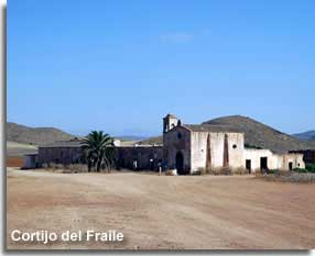 The Good, The Bad and The Ugly. However the location is perhaps more famous for a crime that occurred here in 1928, and from media influences after this event became the inspiration for the novel 'Bodas de Sangre' - The Blood Weddings - composed by the famous writer Frederico Garcia Lorca.
Intrigued?
The local story, one of impossible love and tragedy, is about a young women who lived with her father in the farmhouse at that time, in love with her childhood sweetheart, she was set to be married by arrangement to someone else. Legend tells of how she tried to escape her marriage ceremony and run off with her true love, only to be intercepted by the brother of the groom, resulting in bloodshed and murder, the young women was witness to the shooting of her lover and she herself was left for dead. Although she recovered physically she never recovered her emotional wounds and died a widow many years later.
In a remote location, the cortijo can be reached along track roads from Albaricoques, Rodalquilar or Fernan Perez and is signposted from each village. There is also a signposted walking trail which includes the coritjo and its surrounding countryside. 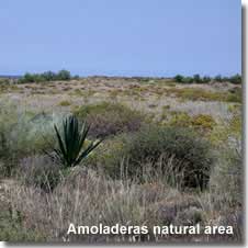
FLORA AND FAUNA - Cabo de Gata
Plant life
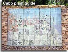
Surprisingly there are more than a thousand different plant species to be found in this Mediterranean semi-desert, an unusual and diverse mix that have had to adapt to environmental conditions such as excessive heat, scarcity of rain water and the volcanic nature of the land. The area is prevented from being completely desertic by its closeness to the sea and a condition know as hidden rainfall, where moisture in form of dew is created from the cooling of the humid air at night time. 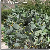 Saltwort and reeds thrive in the salty environment and offer shelter to nesting seabirds. The sand dunes are home to the cottonweed and in the mountains, mostly near the shadier parts of the ramblas, there are gorse, broom, esparto, lichens and palmetto palm trees. Of course the cactus plant can be seen in abundance in the more arid areas. The plant species which stand out the most are the agave, sisal and prickly pears, providing beautiful scenery within the park. The chumbera, prickly pears, were introduced to the region in the 19th century as a
 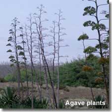 dual purpose food source, the pears for the villagers, and the stalks for the livestock. The agave and the sisal were planted here in the mid 20th century, to provide an industry for the area, their fibres being used in the manufacture of rope and textiles.
Having never seen an Algave plant, my first encounter was on my visit to the Almoladeras visitors centre, the flower stalks of these plants are tall, reaching, I would say, almost triple my 1.6m height, these plants are absolutely stunning, yet they and their isolated location did kind of give me a 'triffid' moment if you know what I mean.
Wild life
In comparison with other semi arid areas Cabo de Gata is home to a quite number of animal species.
Of particular interest is the tarantula spider, its prey, usually small animals, are paralysed with its poison, and while its sting is painful to humans it is not mortal.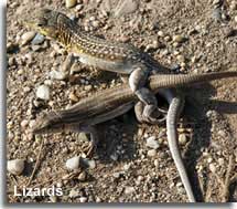 Also present is the Snub Nosed Viper, a venomous snake, it will only bite if disturbed. It is worth being vigilant for their presence if walking among rocks or bushes, however, as all the accessible areas of the park are reached by road or well worn tracks, this really should not cause too much concern.
Easy to spot are the numerous lizard species, including the Spiny-footed lizard, often seen basking in the warm sunshine.
Other species of the natural park include the North African hedgehog, the Montpellier snake, fox, weasel, toads, butterflies, cicada and rabbits.
 Bird life
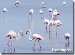
Without doubt this area is a bird watchers paradise, particularly in Las Salinas de Cabo de Gata. The salt flats provide an important habitat for both the resident bird population as well as the migrating birds that stop on their journey between Europe and Africa. More than one hundred different species can be spotted throughout the year, including the elegant Flamingo, whose gatherings peak in the summer time, especially the month of August when their numbers are at an optimum.
The Black Wheateater is the most representative bird of  the Cabo de Gata, it can often be seen near rocky areas, inland or coastal, and among the ruins of many country houses.
The pride of the Cabo de Gata is Bonelli's Eagle, The Great Hunter, it can capture prey up to approximately six kilogrammes in weight such as rabbits, large lizards, snakes and even young foxes. Pairs stay together all their lives and neighbouring couples will respect each others home territory which can cover an area of up to thirty square kilometres. Other birds of prey to be spotted include the Eagle Owl, Common Kestrel and the Peregrine Falcon.
Bird watching in Las Salinas de Cabo de Gata ![]()
Sea life
The rocky seabeds of the marine reserve are protected not only for their outstanding beauty but for their biological importance and ecological conditions. The protected area is over fifty kilometres long by one mile wide and is regulated to ensure preservation, in 2001 this coastal zone was declared a Specially Protected area of Mediterranean Importance, reaffirming its environmental value. 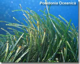
The Posidonia Oceanica, a marine plant that lives in the Mediterranean sea, enjoys an excellent state of preservation in the parks waters, it forms a thick meadow that covers the seabed and protects the coastline from erosion, it also provides a valuable habitat offering food and shelter for the multitude of sea life in the area. The best preserved marine environments of the Cabo de Gata include:
- Cabo de Gata
- Morron de los Genoveses
- Punta de Loma Pelada
- Punta de la Polacra
- Punta Javana
- Punta de la Media Naranja
All are pinpointed on the map further down the page.
FIESTAS of the Cabo de Gata
Fiestas are always a special occasion in Spain, usually a religious celebration, they are often held in honour of the local patron saint of the region or village, and are celebrated round the clock, lasting from 1 day up to 4 days, normally on a weekend, and sometimes an extended one. Visitors are always welcomed and encouraged to join the party.
The table below offers the details of the main village fiestas of Cabo de Gata, the exact dates can vary depending on how the yearly calendar falls, and specific dates would have to be confirmed locally.
| AREA | MONTH | IN HONOR OF |
|---|---|---|
| Ermita Torre Garcia | 1st Sunday in January | Virgen del Mar |
| Cueva del Pajaro | Mid March | San Jose |
| Gafares | Early May | Cruz de Mayo |
| Fernan Perez | Mid May | San Fernando |
| Pozo de los Frailes | Mid June | Virgen del Carmen |
| Pujarie | Mid June | San Antonio de Padua |
| Barranquete | Third week of June | Virgen de la Esperanza |
| All coastal villages | Third week of June | Night Bonfires of San Juan |
| Ruescas | Early July | San Guillermo |
| La Isleta del Moro | Mid July | Virgen del Carmen |
| Agua Amarga | End July | Santiago |
| Albaricoques | End July | Virgen de la Asuncion |
| Rodalquilar | End July | Tourist |
| San Jose | 1st weekend in August | Tourist |
| Las Negras | Mid August | Virgen de la Asuncion |
| San Miguel | Mid August | Virgen del Mar |
| El Saltador | Third week of August | Fiestas |
| El Argamason | Early September | Virgen de la Cabeza |
ACTIVITIES in Cabo de Gata
Walking / Hiking
There are sixteen signposted walking routes within the Cabo de Gata Natural Park, ranging from 1.5km to 11.1km, traversing both coastal and inland areas and incorporating many places of interest.
All trail starting points are pinpointed on the information board in the Amoladeras Visitors Centre and there are pamphlets of each of the walks available to purchase.
Walking trails of the Cabo de Gata ![]()
Water Sports Cabo de Gata
Scuba diving, snorkelling, windsurfing, kitesurfing, kayak, catamaran, boat trips and boat hire, are all available from the numerous water sports centres within the coastal villages of the natural park.
Water sports and water sports centres Cabo de Gata ![]()
Activity Centres and Guided Tours - Cabo de Gata
External links
Provided to help visitors make the most of the area. The links will open in a separate page.
Horse Riding
Hotel Cotijo El Sortillo San Jose. (Website in English).
Mountain Bike Excursions & Rentals
Cabo Activo Albaricoques. (Website in English).
Centro de Buceo Isub San Jose. (Website in English).
Guided Hiking Excursions
Buceo Las Negras Las Negras. (Website in Spanish).
4 X 4 Guided Tours
Malcaminos 4 X 4 Tours Cabo de Gata. (Website and tours available in English).
San Jose Information & Booking Centre for Guided Excursions
San Jose Information Centre.
Address: Avda. San Jose, 27. 04118. San Jose. Tlf: 950 380 299.
Guided Walking, Mountain Biking, 4 X 4 and Coach Excursions are available in different languages including English.
There are several routes to choose from, ranging in duration from half day to full day trips.
The links below are to the website which provides further information but is only available in Spanish. More details are available, in person or by telephone, from the information centre in San Jose.
Walking trips Cabo de Gata.
Mountain biking trips Cabo de Gata.
4 X 4 trips Cabo de Gata.
Coach trips Cabo de Gata.
HOW TO ARRIVE
Cabo de Gata - Nijar Natural Park Map
See below for access information to specific areas of the park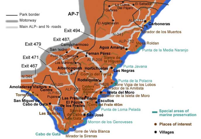
Access to Parque Natural Cabo de Gata
Access to the park from the main Almeria - Murcia motorway (AP-7) as detailed on the map above:
Exit 467 for Las Amoladeras Visitors Centre/ Las Salinas de Cabo de Gata / Cabo de Gata Lighthouse.
Exit 471 (San Jose) for San Jose, Los Escullas, La Isleta del Moro, Playas de los Genoveses and Playa Monsul.
Exit 479 (San Isidro-Nijar) for the same locations as exit 471 taking the route over La Serrata de Nijar mountains.
Exit 487 (Camperhermoso-Las Negras) for Hortichuelas, Las Negras, Rodalquilar.
Exit 494 (Carboneras) for Agua Amarga.
In recent years the intense farming of fruit and vegetables has rapidly developed in the area and many greenhouses have been established, mainly on the outskirts of the natural park and in the surrounding terrain. On approach to the protected area it is impossible not to notice these fields of plastic, they have transformed the countryside in certain areas, however once driven passed, they in no way detract from the beauty of the remaining landscapes.
The park covers a vast area and includes many rural locations, although there are petrol station located both within the park and outside of the border I would recommend, if exploring by vehicle, to have a full tank petrol on arrival.
TOURIST INFORMATION
Visitors centre - information centres - information kiosks
External links
Provided to help visitors make the most of the area. The links will open in a separate page.
Below each information kiosk and the main visitors centre comes with a link to its relevant page, in English, on the Junta de Andalucia website, from where a further link entitled Horarios will provide the opening times of each information point.
The San Jose information centre opening times are provided by the cabodegata-nijar.com website, though the details are only available in Spanish the opening hours and location can be easily understood.
Amoladeras Visitors Centre
This is the main information centre of the park, 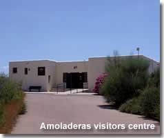 located and signposted along the Retamar-Pujaire stretch of the ALP-202.
The information provided within the centre is mostly available in English, as well as Spanish, and is mainly in the form of well thought out displays covering the geological formation and history of the Cabo de Gata, with details and images of the sea life, birds, animal species and vegetation.
On entrance to the centre there is a large wall map that highlights all the places of interest including the starting and finishing 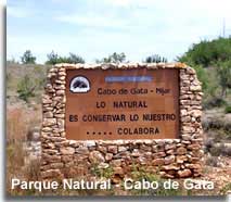 points for each of the walking trails. The locations of the other information centres and kiosks and the locations of the petrol stations are also pinpointed.
Maps and guides of the area are available to buy, and there are plenty of free leaflets advertising accommodation, restaurants, and activities with the park.
As well as tourist information there is a small selection of souvenirs and craft work.
The Amoladeras Visitors Centre including the opening times calendar.
I must say that a visit to this centre is highly recommended, as is the purchase of a map or guide book, getting to know the area really does lead to loving it. 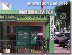
San Jose Information Centre
Located on the main road in San Jose, this information point is also a booking centre for guided walks, cycling trips, and 4x4 excursions, beside offering maps and guides for the area it has internet access and a gift shop.
The San Jose Information Centre including the opening times calendar.
Rodalquilar Information Centre
Located across from the church and close to the botanical gardens, the centre is specific in its focus, the mining history of the village. It has an exhibition room dedicated to the geological mineral wealth of the area and provides maps, guides and details of the local routes of interest, including the old gold mining facility located in the surrounding hills.
The Rodalquilar Information Centre including the opening times calendar.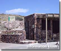
Information Kiosks
The information kiosks provide definitive details of each of the individual locations along with maps, guides and souvenirs.
- Los Muertos Information Kiosk
- La Amatista Information Kiosk
- Isleta del Moro Information Kiosk
- Noria del Pozo de los Frailes Information Kiosk
- Las Sirenas Information Kiosk
Respect of the Natural Park
- Drive carefully and keep to the recommended speeds
- Only use the signposted tracks and roads and NEVER drive through any other path
- When cycling or riding give preference to walkers
- When sailing or boating keep 200 metres clear from the shore and never anchor in places that could damage the sea bed
- Leave each location as you would expect to find it


