Sierra Gador
Almeria - Andalucia - Southern Spain
The Sierra Gador mountains and the Almeria Alpujarra villages, an outstanding destination for history and culture in a unique mountain setting. 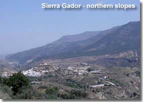
Gador mountain range
Sierra Gador, the most southerly mountain range of Almeria, lies between the Mediterranean sea and the Sierra Nevada, extending from sea level to over 2000m. Climate conditions can vary enormously depending on the season and altitude, as does the landscape, with snow topped peaks, 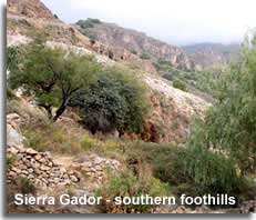 limestone ravines and woodland forests.
The southern slopes and northern valleys of the range form two distinct regions of the mountains, in the sierras western limits these two areas are linked by the A-347 roadway, from Berja in the south to Alcolea in the north. 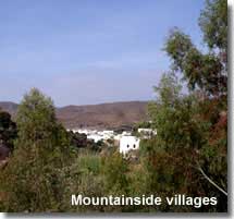 The AP-7 motorway runs along the southern extremes of the mountains and the A-348 traverses the countryside and villages in the northern foothills.
Quick links - Sierra Gador:
- Celin village including the Arroyo de Celin recreational area and the ruins of the Baños de Reina Arabic baths
- Castala Park mountainside recreational area
- Meet the Alpujarra valley villages
Choose Sierra Gador for history and culture
Discover the hillside village of Celin, where history and culture meet beauty and nature...
Uncover the old mining traditions of Sierra Gador on one of the many mountain trails...
Meet the Alpujarra villages in the northern valleys...
Sierra Gador - southern slopes
The southern limits of Sierra Gador extend towards the coast and include the districts of Berja, Dalias, Vicar, Felix and Enix. It has to be said that the plains between the mountains and the sea are known for the intense agricultural farming of fruit and vegetables and the valley vistas are encumbered by widespread areas of plastic covered greenhouses. It must also be said that the natural beauty found within these mountains, valleys, and charming hillside villages far outweigh this economic necessity. 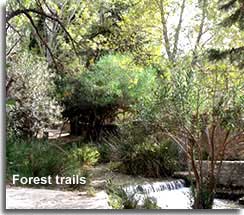
Local history
With ancient influences from periods of significant historical consequence, dating back to Roman times, including the extensive Arab reign of Southern Spain, and the eventual Christian dominance, to a more recent affluent mining history, the villages in the foothill of Sierra Gador offer access to a wealth of culture along with amazing mountainside scenery, extensive forest trails, and a unique destination for the enjoyment of outdoor recreational activities. 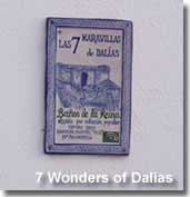
There is so much to explore in the Gador mountains, below I have provided details of the special destinations that I have discovered on my travels here, which are perfect for day trips and excursions, hope you enjoy.
Celin
Mountain excursions
A subsidiary of the district of Dalias, the tranquil hillside village of Celin is home to five of the seven Maravillas de Dalias, the Arroyo de Celin, Fuente de Celin, the Baños de Reina, the hilltop Ermita de Aljizar and the Iglesia de Celin. Translated, the five wonders of Dalias located in Celin are the stream and fountain, the 14th century Moorish baths, the hilltop chapel and village church.
This is 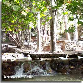 a dream of a village from which to explore the countryside, experience the local history, and access the mountains, below I have detailed the recommended destinations of the village and access points to the surrounding hills. A recommend a day out, with a choice of signposted walking, cycling or drive trails, and the opportunity for a relaxing picnic by the shaded stream.
The Arroyo de Celin Recreational Area
The recreational area of Celin is centred around its stream and water fountain, and is fundamentally a family picnic area under a canopy of woodland trees in a most picturesque mountainside setting, offering signposted options for exploring.
The lengthy walking trails, covering a total distance of 33km, 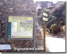 including the 22km PR A-113 mountain route, are detailed on a map beside the entry point of the recreational area.
Walking trails in Sierra Gador ![]()
Miradors - El Palain and Pecho de Los Aceres
The mountain viewing points of El Palain and Pecho de Los Aceres, at a distance of 9km and 20km respectively, are also signposted from the entrance of the recreational area. The sign indicates that this narrow mountain trail can be taken by vehicle or mountain bike.
Baños de Reina
A representation of the ancient Arabic bathing culture, 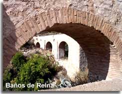 the ruins of the Baños de Reina date back to the Nasrid dynasty of 14th century Andalucia. The baths were a social place, incorporating three sections of bathing, temperate, hot and cold, they were used in times of public ceremonies and to satisfy the obligations of the Moslem faith in the cleansing of the body and spirit.
The Baños de Reina are included on the small local walking trail to the Ermita Aljizar, the trail is signposted from the village. 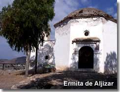
Ermita Aljizar
Situated on a hilltop overlooking the village and valley and reached along a steep and winding, yet short track, between terraces of local grape vine farms. The Ermita is formed by two buildings, the Torre, a 14th century Moorish tower and the 18th century Christian chapel.
Access to Celin is from the A-358, the detailed attractions can be found by following the signpost for Arroyo de Celin on arrival at the village.
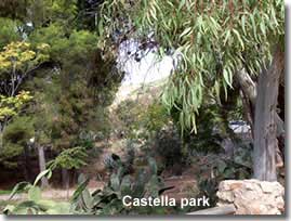
Castala Peri-Urban Park
The Parque Periurbano Castala recreation area is a natural oasis of serenity located in the municipal district of Berja on the southern slopes of Sierra Gador at 700m above sea level. Covering an area of approximately 140,000 square metres, the nature park was declared an area of special protection in May 2000. A reforested zone of Aleppo pines, and home to a wealth of local bird life, the hillsides provide an area for outdoor activities in an easy to access location roughly five kilometres from the town centre of Berja. 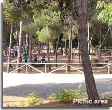 The spacious areas within the park, which are accessible by vehicle on tarmac roads, include several shaded areas for picnics, play areas for children, sports areas, a swimming pool for use in the summer months, water fountains, a restaurant, and several parking areas.
There are three signed mountain walking trails 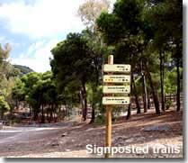 which can be undertaken from within the parks boundaries, their starting points are signposted throughout the park and their itineraries are detailed on a placard and map at the start of the routes.
Specialist mountain climbing and paragliding zones are also indicated.
Walking trails in Sierra Gador ![]()
Castala Park is signposted from Berja along the ALP-605.
External link
Provided to help visitors make the most of the area. The link will open in a separate page.
Peri -Urban Park Castala, further information provided by the Junta de Andalucia website, in English.
Sierra Gador - northern valleys
Las Alpujarras Almeria
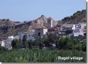
The northern foothills of Sierra Gador meet the southern slopes of the Sierra Nevada in a series valleys and ravines known as Las Alpujarras. An arable area of immense beauty made fertile from the rivers descending from the mountains, with picturesque white villages nestled in the hillsides.
The Alpujarra municipalities along the lower inclines of Sierra Gador include Alhama de Almeria, Huecija, Illar, Instincion, Ragol, Canjayar, Padules, Fondon and Alcolea.
With panoramas to the Sierra Nevada, this is a truly beautiful region with the wonders of the Sierra Nevada nature park right on the doorstep.
Las Alpujarras, and Sierra Nevada, are perhaps more recognised in context with Granada province rather than Almeria, however, the Alpujarra valleys, the Sierra Nevada mountains and the Sierra Nevada nature park exist in both provinces. The Sierra Nevada is also well known for its winter ski resort, which is situated in Granada.
Las Alpujarras Almeriense including the Sierra Nevada nature park ![]()
The Sierras of Almeria
An introduction to the mountains of Almeria including location map ![]()


